Category Archives: Projects
Máquinas visuales para un mundo herido
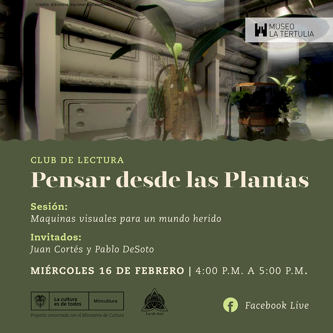
Encuentro con la red latinoamericana de humanidades ambientales, 16 febrero 2022.
Protected: Asap Journal
There is no excerpt because this is a protected post.
AA Visiting School Melbourne
In ‘Bio-Cultural’, we will propose Bio-Cultural Architecture. Devices which generate the ecosystems of tomorrow and strengthen our interdependence.
Protected: Resist as Forest Soundscape
There is no excerpt because this is a protected post.
Arquitectura Ambiental
Universidade UFPB PPGAU Semestre 2020.1 Créditos/carga horária 1Cr /15h Datas/Horario Terças 9h a 12h (24 Março a 7 Maio) Local Online EMENTA A nossa casa está a arder, como explica Greta Thunberg. Queimadas e desmatamento crescentes na Amazônia, rompimento de barragens em Minas Gerais e morte do Rio Doce, emergência climática, são as noticias de …
Cartography of a Techno-political Assassination
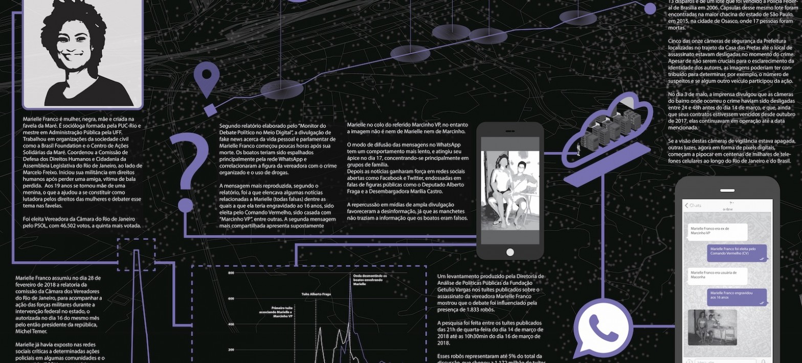
Cartography of a Physical & Digital Assassination This project brings a visual exploration of the physical and digital layers surrounding the death of Marielle Franco. If it was not enough to kill her on the streets, the murder was followed by the attack on her public figure through the circulation of fake news and images in …
Continue reading “Cartography of a Techno-political Assassination”
CV
Qualifications PhD Federal University of Rio de Janeiro, Communication and Culture, 2016. MA Royal Institute of Technology of Stockholm, Architecture, 2007. BA University of Seville, Architecture, 2003. Awards & Grants 2019 NTNU ARTEC Artist in Residence 2018 6th DKV – Álvarez Margaride Production Scholarship, organised by LABoral Centro de Arte & DKV 2013 Elinor Ostrom …
Resist as Forest
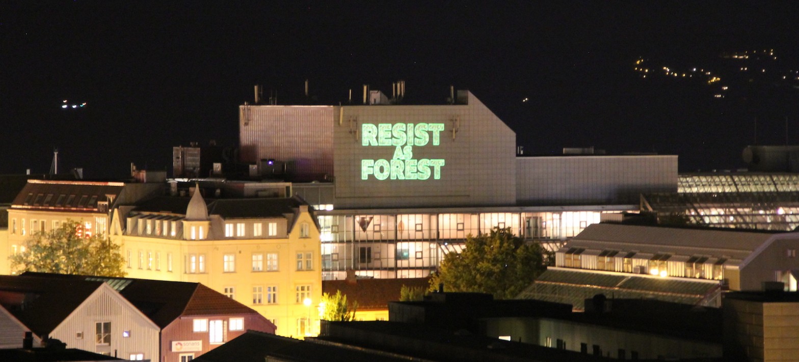
A site-specific public art intervention designed for Adressaparken in Trondheim, as part of the NTNU (Norwegian University of Science & Technology) Artec Award.
Aerial mapping of Vila Autodromo
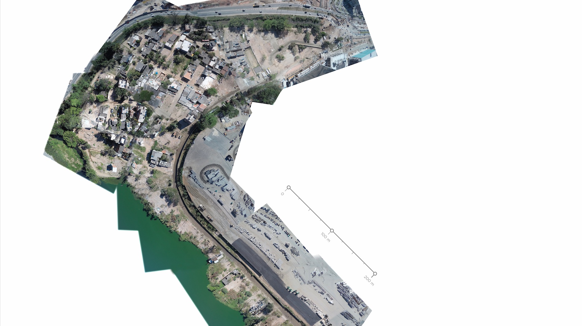
What does a resilient community against neoliberal urbanism look like from the sky? Vila Autodromo is a local community in Barra de Tijuca facing real state violence from construction companies and the local goverment close to place of Rio 2016 Olympics.
The Global Street
The Global Street is an online video-cartography comissioned by the project ‘Making Change’ (Leuphana University + HIVOS Foundation).
Mapping the Commons
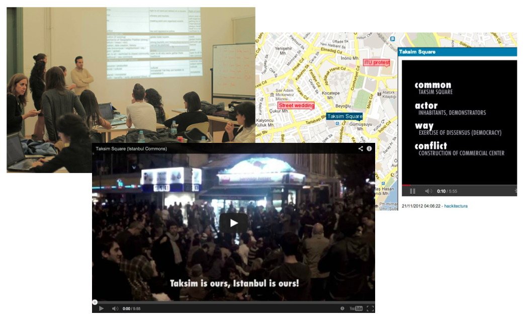
A research project and a open urban laboratory to explore that complex concept called the urban commons.
Metropolitan Videocartography Medellín
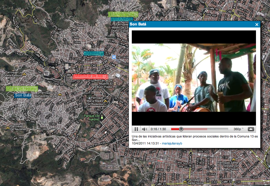
Taller de videocartografía metropolitana, Medellín “Los suburbios de las ciudades del tercer mundo son el nuevo escenario geopolítico decisivo” Mike Davis (Planet of Slums) “Sea arte, sea deporte, sea de la manera que sea, queremos seguir arrebatando jóvenes a la violencia. Medellín no está lleno de sicarios, esto está lleno de talento urbano.” Falco (artista …
Citizen Cartography International Symposium
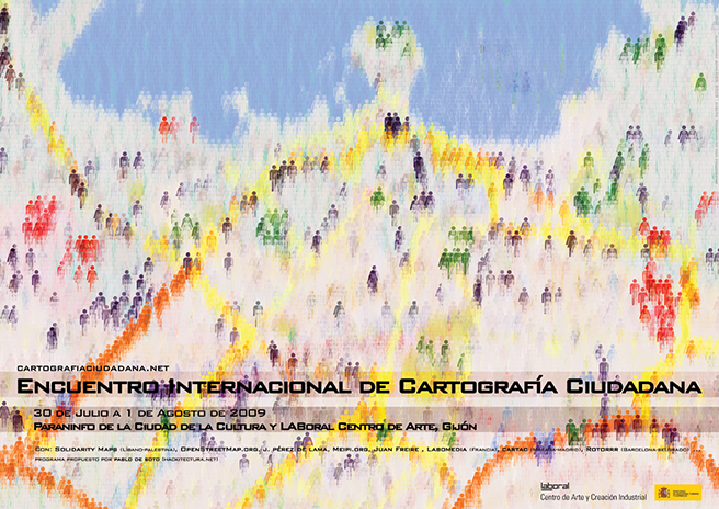
El I Encuentro Internacional de Cartografía Ciudadana tuvo lugar en el Paraninfo de la Ciudad de la Cultura y en LABoral Centro de Arte de Gijón entre el 30 de julio y el 1 de agosto de 2009. El encuentro reunió por primera vez bajo esa temática a un amplio grupo de investigadores y activistas de diferentes ámbitos: arquitectura, periodismo, …
Continue reading “Citizen Cartography International Symposium”
Open Street Maps for Kids
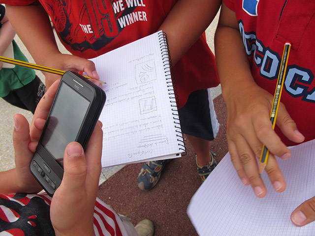
La actividad introdujo el arte de la cartografía mediante un ejercicio lúdico al aire libre de “mapeo” del territorio con técnicas digitales.
Gaza cartography
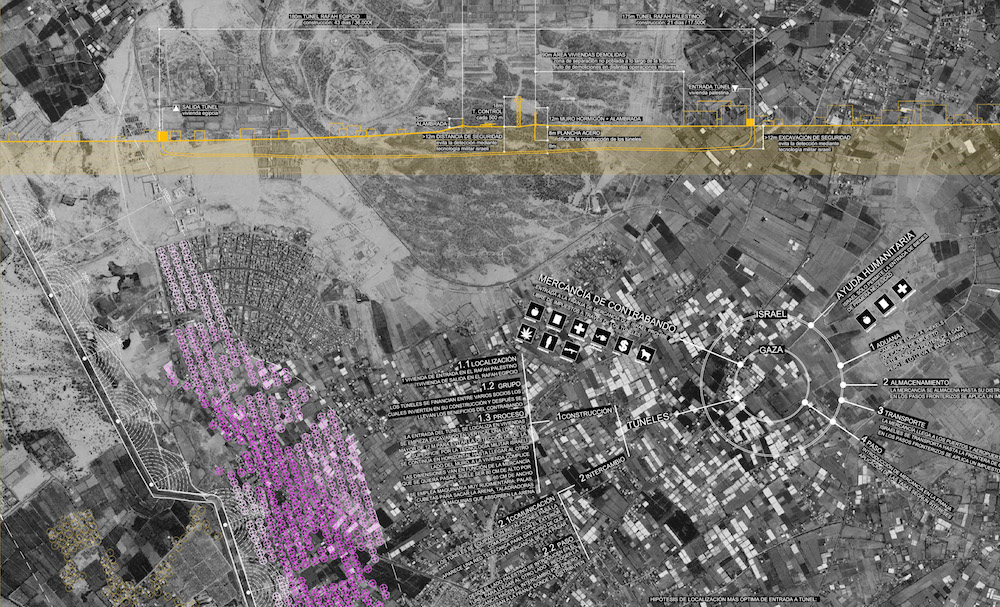
Este trabajo recoge un catálogo de mapas, software y vídeos coordinados de forma narrativa usando tecnologías avanzadas de descripción del espacio (GIS, Software, Modelado 3D) mostrando aspectos que no serían evidentes en una primera lectura. Pueden ser extrapolados a territorios y contextos de paz sujetos a tensiones y transformaciones en que la arquitectura y el …
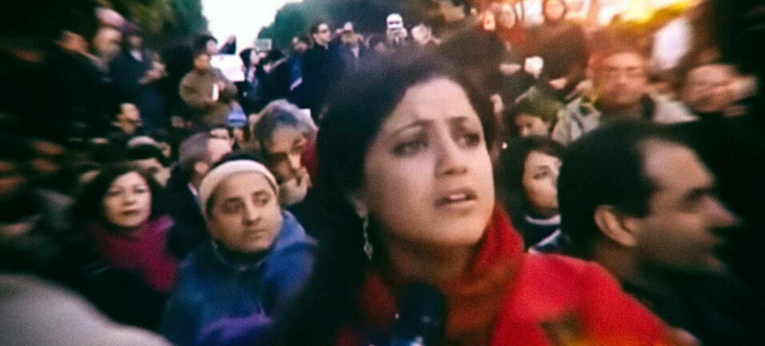
From Cairo to Gaza
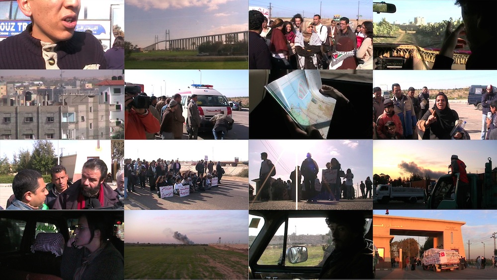
A documentary road movie that runs the 330km that separate Cairo from the southern border of Gaza during the days of Operation Cast Lead in January 2009, which caused more than 1,400 deaths and thousands of wounded among the Palestinian population. The trips follow the attempts of Egyptian civil society to break the blockade imposed …
WikiPlaza
WikiPlaza was an experimental, long-term project that brought together several collectives of architects, hackers and activists. The idea sprung up of generating a hybrid public space in which to experiment with information and communication technologies as tools for individual and communal emancipation, based on free software and hardware, web 2.0 tools and an open and …
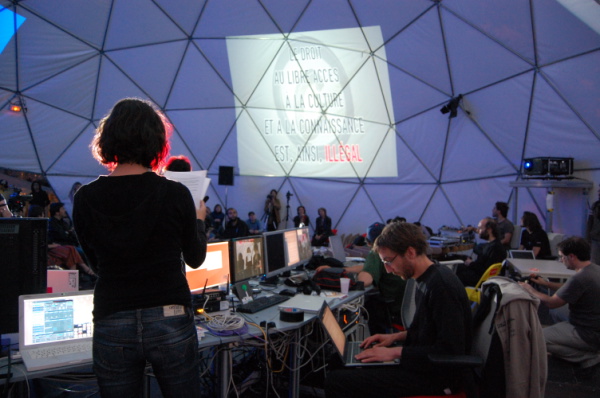
Situation Room
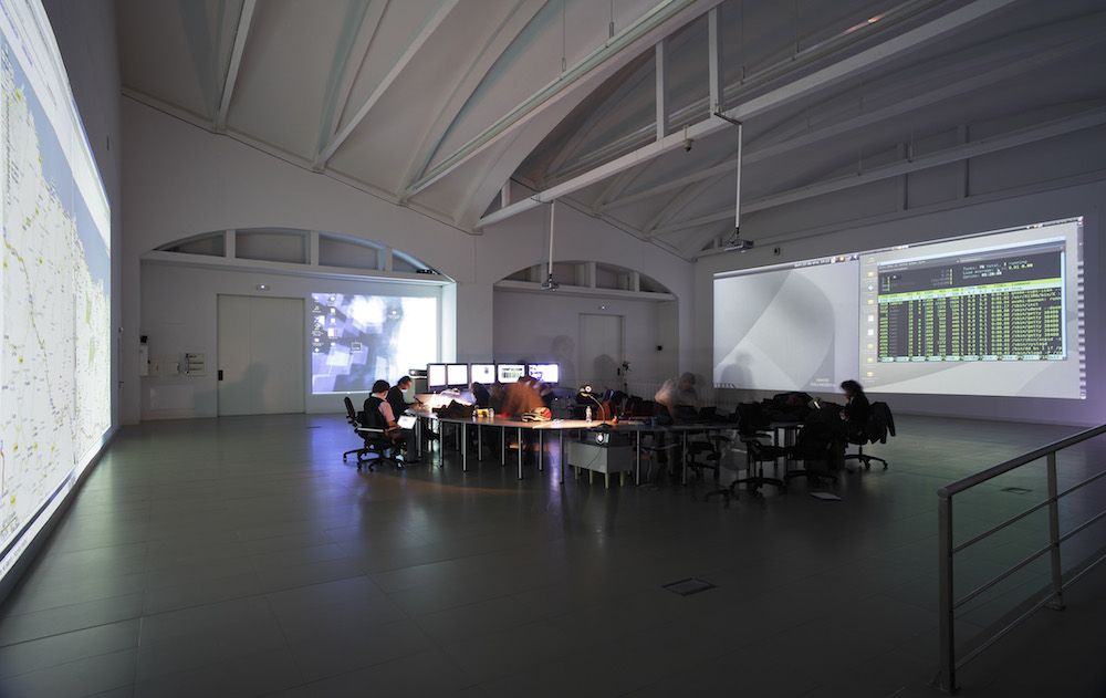
The term Situation Room is normally used to designate a secret place used in times of crisis to assess and monitor data for decision making purposes. Its origins can be traced back to World War II with the invention of computers, digitalization, and the collaboration of architects and the military. These rooms are equipped with …
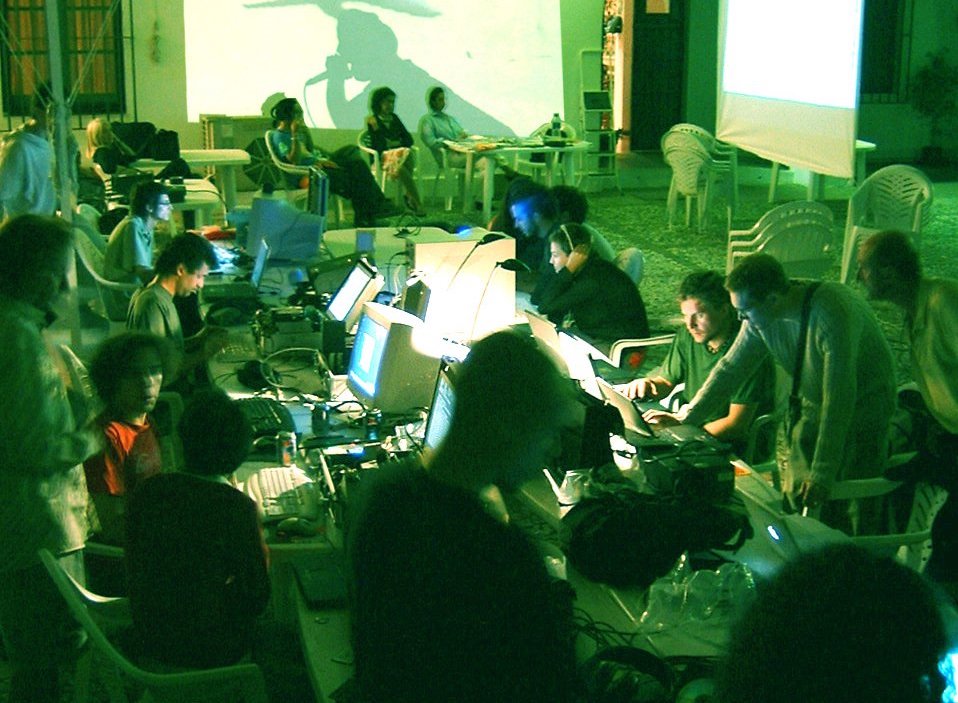
Technological Observatory of the Straits
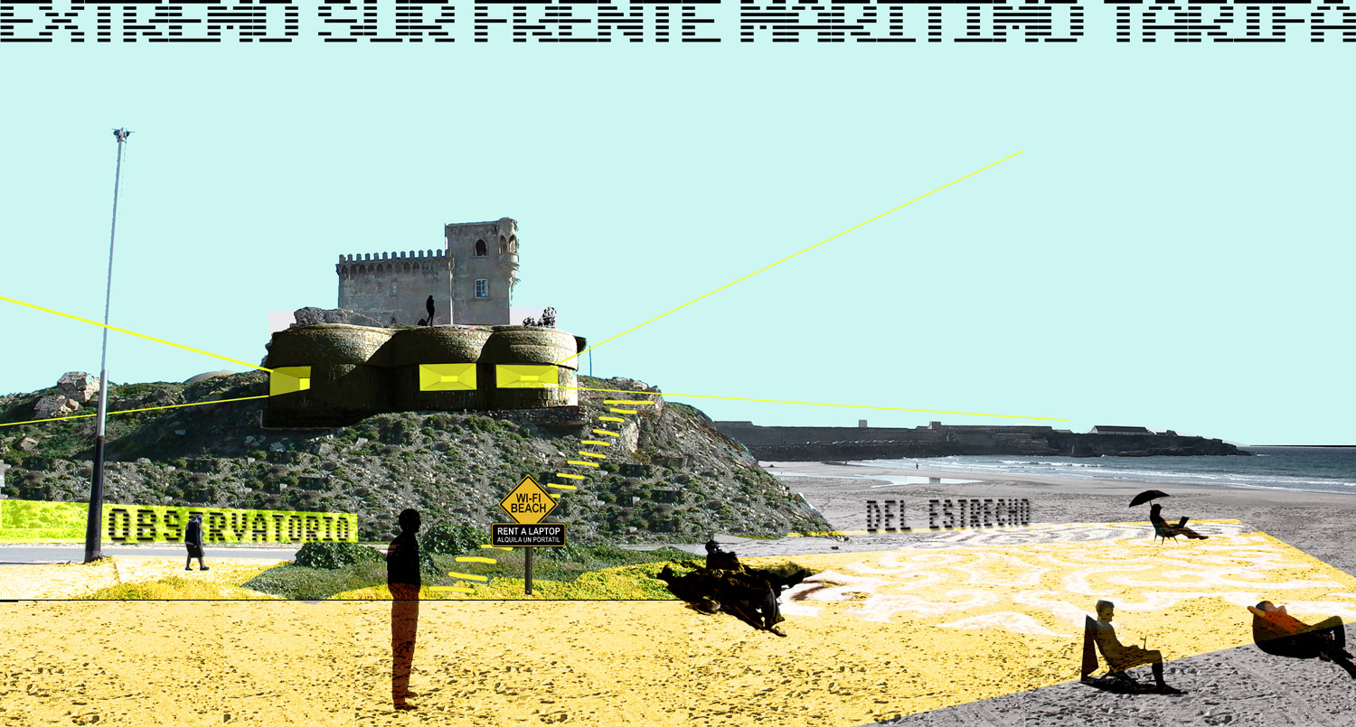
Many meetings and workshops organised led to a process of discussion and experimentation that eventually produced the idea of the Technological Observatory of the Straits. Some of the main issues that intersect with the transformations now in process, as discussed above, are beginning to overlap and cross each other, and so common hypotheses are being …
Critical Cartography of the Straits of Gibraltar
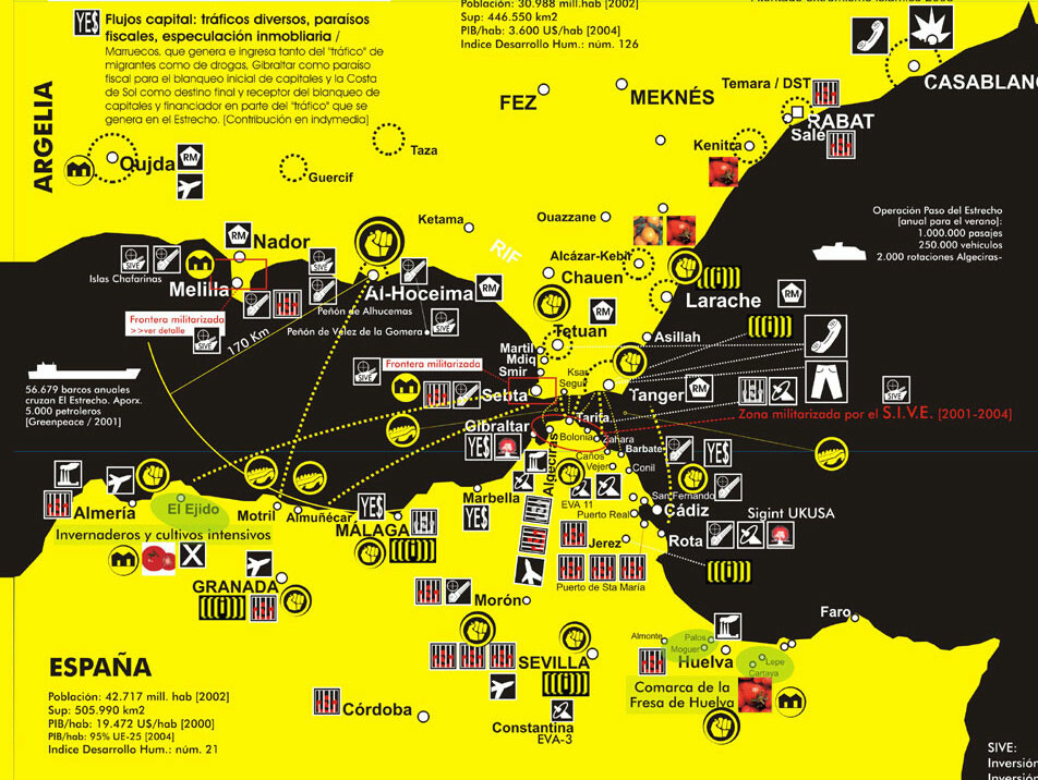
Hackitectura’s map Cartografía Crítica del Estrecho (Cartography of the Straits of Gibraltar) creates an alternative understanding of the Spanish-Moroccan border region. The border is not an abstract geopolitical line but an increasingly complicated, contested space. The inversely oriented (north at the bottom) map highlights connections between southern Spain and northern Morocco to show a single …
Continue reading “Critical Cartography of the Straits of Gibraltar”
Fadaiat: freedom of movement, freedom of knowledge
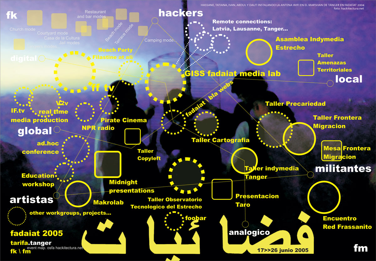
The straits of gibraltar is a mirror-territory of the transformations taking place in the world today: globalisation, migrations, borders, citizenship, network-society, communication, technologies… the border is a crossed-place, an extensive territory of life and mobile confinements where multiple social practices put pressure on established limits. new spaces and relationships emerge from and through the border …
Continue reading “Fadaiat: freedom of movement, freedom of knowledge”
Seville Global Map
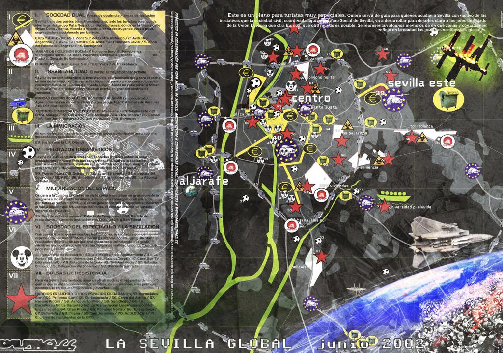
In Seville, on the eve of a large EU summit and concomitant protests in 2002, a collaborative mapping project was carried out with different community organizations to try to represent different effects of globalization on the city. The project drew on Zapatista frameworks of understanding, particularly those from the communiqués on “Seven Loose Pieces of …
The connected multitude
The Connected Multitude was a prototype for a networked public space, produced for a network of activists, artists and technicians. Using technologies such as a bi-directional satellite connection, wifi (in its infancy at the time) and streaming with free software, – with real time connections to México DF, Bogotá, Paris or El Viso del Alcor …