Un curador y académico con una experiencia iconoclasta que trasciende las fronteras geográficas y disciplinarias.
Autor: pablodesoto
‹ Volver atrás
Mapeando o Comum Urbano
Universidade
UFPB PPGAU
Código
SPPGAU5002 – T01 e SPPGAU5002 – T02
Professores
Pablo DeSoto & Leticia Palazzi + Andrea Porto DGEOC (Departamento de Geociências) & Paulo Rossi IESP (Instituto de Educação Superior da Paraíba) (colaboradores)
Créditos/carga horária
4Cr/60h (Pos), 3Cr/45h (Graduaçao)
Semestre
2019.2
Datas/Horario
21 a 26 de Outubro, 16 a 22 h
Local
Fundação Espaço Cultural José Lins do Rego
EMENTA
Curso teórico-pratico de exploração, discussão e mapeamento dos bens comuns urbanos ou comum urbano (urban commons). Toma a forma principal de laboratório inter-disciplinar onde encontram-se para trabalhar juntos arquitetos, geógrafos, ativistas, artistas visuais, científicos sociais e estudantes de diferentes disciplinas. O curso propõe um método de laboratório, desenvolvido anteriormente em varias cidades do mundo e ganhador do Premio Elinor Ostrom por a Universidade de Buenos Aires, no qual o comum urbano é estudado, parametrizado e apresentado em formato visual e cartográfico. O laboratório abrange a grande João Pessoa como objeto de estudo para a produção de uma contra-cartografia em grande formato sobre seus bens comuns da área metropolitana, que possa contribuir como dispositivo publico nas discussoes e conflitos em andamento.
Estudo dirigido – 27 Agosto a 12 Outubro. Online. Leitura e análise dos livros e artigos principais da bibliografia.
Aulas teóricas e Laboratório de cartografia. – 21 a 25 de Outubro. Espaço Cultural, 16 a 22h. Aula 1: contra-cartografia. Aula 2: comum. Aula 3: cidade.
Intervençao urbana – 26 de Outubro. Corais de Seixas.
BIBLIOGRAFIA
DeSoto, P., Delinikolas, D., Dragona, D., Senel, A. and Pérez de Lama, J.P. 2015. Mapping the Urban Commons: a Parametrical and Audiovisual Method. V!RUS, 11.
Halder, S., e Kollektiv Orangotango, orgs. This Is Not an Atlas: A Global Collection of Counter-Cartographies. First edition. Social and Cultural Geography, Volume 26. Bielefeld: transcript, 2018.
Hardt, M., Negri, A. Bem Estar Común. 2016.
Harvey, D. Ciudades rebeldes. Del Derecho de la ciudad a revolución urbana. 2012
Resultados
Quatro principais bens comuns ameaçados da cidade de João Pessoa foram identificados e parametrizados no Curso: o Rio Gramame, que é a principal fonte de abastecimento de água da região metropolitana, se encontra poluído pelos agrotóxicos da agricultura e rejeitos industriais; o Rio Jaguaribe, que atravessa a cidade de sul a norte recebendo esgotos domésticos e resíduos depositados de modo irregular no sistema de drenagem da cidade; o Rio Sanhauá e o Porto do Capim, berço e patrimônio histórico da cidade, são alvos recentes da especulação imobiliária e do turismo predatório; e por fim, o sistema de falésias do Cabo Branco, que é margeado pelo terceiro maior recife de corais do mundo, e que vem sendo destruído pela supressão da mata atlântica e um sistema inadequado de drenagem.
O curso culminou em uma ação direta de cidadania que foi realizada durante a manhã do sábado 26 de Outubro nas “Piscinas Naturais de Corais da Praia do Seixas”, que situa-se no litoral sul e fica em frente à “Falésia do Cabo Branco” e ao Farol do Cabo Branco e à Estação Cabo Branco – Ciência, Cultura e Artes.
‹ Volver atrás
Critical Inquiries to the Anthropocene
The course Critical Inquiries to the Anthropocene took place at Centro de Pesquisa e Formação SESC São Paulo, from 27th to 29th March 2018 (3h per day). It was conceptualized by Pablo DeSoto and produced by Daniel González Xavier.
The course proposed a critical approach to the Anthropocene, with theoretical debates and methodological proposals in the conjunction between the arts and sciences. It was conducted by Pablo DeSoto and Renzo Taddei, a professor at UNIFESP Instituto do Mar. Around forty students from very different backgrounds attended it.
Program:
– Day 1
The Anthropocene as both geophysical and cultural concept. Pablo DeSoto
Knowing (in) the Anthropocene. Renzo Taddei
– Day 2
The conflicts of tomorrow and the need to think the unthinkable. Renzo Taddei
Anthropocene, Capitalocene, Chthulucene, staying with the trouble in Fukushima. Pablo DeSoto
“To be able to resist we must become forest – and resist as forest. Like a forest that knows that it carries the ruins, that carries with it both what is and what is no longer. It seems to me that it is this political-affective feeling that we need to shape to make sense of our action.” Eliane Brum, Rainforest Journalism Fund meeting, Manaus, Brazil (12/7/2019).
RESIST AS FOREST, an ARTEC-produced art exhibition and cityscape installation
@ Adressaparken, an interactive cyberpark, September 27th 2019
Resist as Forest was a site-specific art intervention designed for Adressaparken, an interactive park in Trondheim as part of the NTNU Artist-in Resident Program. It was created by Pablo DeSoto, a Brazil-based scholar and cartographer and the 2019 NTNU ARTEC Artist in Residence and curated by Hanna Musiol (ISL/ARTEC), together with local artists, scholars, technologists, and community members (Alex Murray-Leslie, Andrew Perkis, Sara Brinch, Olga Lehman, Shreejay Shrestha, Vilde Borgan, and Ada Hoel). It was directly inspired by the work on deforestation, art, and knowledge-making of an award-winning journalist and writer, Eliane Brum. The material for the video and sound installation had been developed in a series of workshops and lectures in Brazil and Norway, in collaboration with NTNU students, artists, and environmental activists.
multilingual environmental storytelling session
Resist as Forest used the Trondheim interactive park, Adressaparken, but also expanded the form and scope of the artistic intervention. It involved an immersive sound installation, a cityscape 3D video projection on the Olavskvartallen, a multilingual environmental storytelling session, a street theatre, and a public assembly. The sound installation at Adressaparken was a composition mixing public domain Amazon wildlife sounds and local Norwegian rainforest, together with multilingual statements from forest protectors, local and transnational artists, scholars, and students. On September 27, as part of the Global Climate Strike, Adressaparken was converted into a temporary planetary art space for artist and civic engagement devoted to the current ecological crisis in the Amazon rainforest and beyond.
Institutional Partners: The event was organized by NTNU ARTEC and Adressaparken with the support of the Humanities Faculty, Trondheim Kunstakademiet (KiT) at NTNU, Trondheim PoesiKveld, and Gibberish / Artistic Directors: Pablo DeSoto and Alexandra Murray-Leslie / Curator: Hanna Musiol / Organizers: Hanna Musiol, Andrew Perkis, and Sara Brinch / Moderators: Olga Lehmann, Sophia Efstathiou, Stella Mililli / Student Assistants: Shreejay Shreshta, Vilde Borgan, Sepehr Haghighi
Special thanks for advice, resources, soundwork, images, tech support, & trust: Dagfinn Dybvig; Sofie Månsson; Irene Dominguez & World Cultures United; the Kayapo people; Andreas Bergsland; Robin Støckert; Aajege, Ánde Somby, Helen Murray, and Aida Miron; Frank Ekeberg; codeofconscience.org; the Macaulay Library; students @ Music / Music Technology, Trondheim Kunstakademiet (KIT) & Department of Language and Literature: Christopher Logan, Siddharth Gautam Singh, Ada Mathea Hoel, Unnur Andrea Einarsdóttir, Mina Paasche, Joachim Sture, Jørgen Wassvik, Berke Ince, Lisa Størseth Pettersen, Samrridhi Kukreja, Jennifer Petzold, Srinavin Shiva, Chen Lili Zaneta Jianing Zuo, Erin Akawachi, Hilde Edvardsen, Karolina Jawad, Aage A. Mikalsen, Sigrid Voll Bøyum, Woon Ting Chan, Bjørg Madelén Gamborg-Nielsen, Mahsa Hamed Mousaviyan, Laura Henrike Hurenkamp, Erina Kawachi, Trond Nesheim, Jennifer Petzold, Srinavin Kumar Raja, Shiva Sherveh, Lili Zaneta, Jianing Zuo, Brooke Eriksen, Mari Ellevseth Oseland, Jørgen Vie, & Vova Gabissov; Krzysztof Orleanski, Adressaparken; Besteforeldrenes Klimaaksjon & Natur og Ungdom; Heli Aaltonen; NTNU Environmental Humanities Research group; Litteratur for Inkludering; & Kunsthall Trondheim.
‹ Volver atrás
Critical Inquiries to the Anthropocene
A work-in-progress book based on the course Critical Inquiries to the Anthropocene that took place at Centro de Pesquisa e Formação SESC São Paulo, from 27th to 29th March 2018, conducted by Pablo DeSoto and Renzo Taddei, a professor at UNIFESP Instituto do Mar. The course proposed a critical approach to the Anthropocene, with theoretical debates and methodological proposals in the conjunction between the arts and sciences.
—
Um livro em construção baseado no curso Indagações Críticas ao Antropoceno, realizado no Centro de Pesquisa e Formação SESC São Paulo, de 27 a 29 de março de 2018, com os professores Pablo DeSoto e Renzo Taddei, do Instituto do Mar da UNIFESP. O curso propôs uma abordagem crítica ao Antropoceno, com debates teóricos e propostas metodológicas na conjunção entre as artes e as ciências.
Título:
Indagações Criticas ao Antropoceno
Capítulos:
1. Introdução, DeSoto & Tadei
2. Indagações críticas ao Antropoceno, DeSoto
3. Conhecendo (n)o Antropoceno, Taddei
4. Os conflitos do hoje e amanhã e a necessidade de elaborar o impensável, Taddei
5. Vivendo com o problema em Fukushima, DeSoto
6. O ensino de Arquitetura no Antropoceno/Capitaloceno: uma experiencia pedagogica nas fronteiras do extrativismo em Minas Gerais, DeSoto & Piva
7. Conclusão, Tadei & DeSoto
‹ Volver atrás
The River as Commongood, the River as Classroom
Planet Earth, South America, Brazil, Paraíba, João Pessoa.
Floating class on João Pessoa’s endangered commons held on the Sanhauá & Paraíba rivers on July 28, 2019, in collaboration with Andréa Porto-Sales, geographer, and André Chein Alonso, a biologist.
The classroom is understood as the place where the construction of global/local challenge resolutions is possible. And for that, not only must it have the necessary conditions to develop the skills and competencies required to «save the planet,» but first of all, it must be the path by which the will to do so is aroused.
—–
Planeta Terra, America do Sul, Brasil, Paraíba, João Pessoa.
Aula flutuante sobre os bens comuns ameaçados de João Pessoa realizada no rios Sanhauá & Paraíba no 28 de Julho de 2019 em colaboração com Andréa Porto-Sales, geógrafa, e André Chein Alonso, biólogo.
A sala de aula entendida como o lugar no qual a construção das resoluções dos desafios globais/locais são possíveis. E para isso, ela não só precisa ter as condições necessárias para desenvolver as habilidades e competências exigidas para “salvar o planeta”, como antes de tudo, deve ser o caminho pelo qual a vontade para fazer isso é despertada.
Projeto de Edificações em áreas de interesse histórico. Conservação e renovação arquitetônica. Aspectos relativos à percepção dos conjuntos arquitetônicos em áreas de interesse histórico-cultural.
2. OBJETIVO GERAL
Desenvolver anteprojeto arquitetónico de valor histórico-patrimonial e carater de memorial na localidade de Bento Rodrigues.
3. OBJETIVOS ESPECÍFICOS
Desenvolver técnicas avançadas de coleta de dados em áreas de interesse histórico; entender a traves da cartografia os processos históricos em suas múltiplas escalas sócias, económicas e ambientais; desenvolver visão crítica sobre a área de intervenção entendendo as dinâmicas ali instaladas mas também as redes e fenômenos amplos vinculados; propor programa de intervenção buscando novos cenários ligados à contemporaneidade; desenvolver composições arquitetônicas que possam se integrar ao entorno já construído; desenvolver capacidades para trabalho colaborativo e interdisciplinar; introduzir as escala planetária na concepção do projeto arquitetônica.
4. INTRODUÇÃO
Tomando como ponto de partida a consideração da zona cero da catástrofe de Mariana – o maior desastre ambiental da historia de Brasil – como área de interesse histórico, o curso propone uma intervenção arquitetônica no seu epicentro emblemático: as ruínas de Bento Rodrigues.
No final de ano 2015 a pequena localidade mineira de Bento Rodrigues (Mariana, MG) se convertia numa Pompeia contemporânea, uma memória iconográfica que o tempo congelou. A diferencia da cidade romana, a total destruição da localidade não tinha origem num evento natural -um vulcano-, mas antropogênico – o rompimento de um barragem construído para acomodar os rejeitos provenientes da extração do minério de ferro que são retirados de extensas minas na região. A lama produz 19 mortes diretas de moradores e danificou a bacia do Rio Doce e uma grande área costa atlântica do Brasil.
5. SITIO
Bento Rodrigues é um subdistrito no município mineiro de Mariana. O subdistrito encontra-se a 35 km do centro de Mariana e a 124 km de distância da capital do Estado, Belo Horizonte. Em 2015, Bento Rodrigues tinha uma população estimada em 600 habitantes, que ocupavam cerca de 200 imóveis. O subdistrito foi um importante centro de mineração do século XVIII e o caminho da histórica Estrada Real atravessa seu centro urbano, ligando-o aos distritos de Santa Rita Durão e de Camargos. Atualmente a área ainda se caracteriza pela intensa atividade de extração mineral. No subdistrito se localizam as barragens de rejeitos de mineração denominadas Fundão e de Santarém, ambas operadas pela empresa mineradora Samarco. Além da mineração, o turismo também movimenta a economia local. Bento Rodrigues conta com um hotel fazenda logo na entrada do subdistrito, além de belezas naturais como Cachoeira do Ouro Fino, uma queda d’água de 15 metros, com lago de 5×3 metros e profundidade máxima de 1,5 m. Nas adjacências do subdistrito, além do rio Gualaxo do Norte, localizam-se distritos e povoados como os de Paracatu, Paracatu de Baixo, Rio Doce, Camargos, Barra Longa, Santa Rita Durão, Barreiro e Gesteira. Um novo povoado de Bento Rodrigues será construído para que os antigos habitantes possam deixar as casas alugadas e voltar às suas vidas. Em maio de 2016, foi decidido que os prédios ficarão em um terreno a cerca de nove quilômetros do distrito destruído; uma área de 89 hectares de propriedade conhecida por Lavoura, de propriedade da ArcelorMittal. O uso para o sitio atual de Bento Rodrigues fica por determinar.
6. O ACONTECIMENTO
O rompimento da barragem de Fundão, localizada no subdistrito de Bento Rodrigues, a 35 km do centro do município brasileiro de Mariana, Minas Gerais, ocorreu na tarde de 5 de novembro de 2015. Rompeu-se uma barragem de rejeitos de mineração controlada pela Samarco Mineração S.A., um empreendimento conjunto das maiores empresas de mineração do mundo, a brasileira Vale S.A. e a anglo-australiana BHP Billiton. Inicialmente, a mineradora Samarco informou que duas barragens haviam se rompido – a de Fundão e a de Santarém. Porém, no dia 16 de novembro, a Samarco retificou a informação, afirmando que apenas a barragem de Fundão havia se rompido. O rompimento de Fundão provocou o vazamento dos rejeitos que passaram por cima de Santarém, que, entretanto, não se rompeu. As barragens foram construídas para acomodar os rejeitos provenientes da extração do minério de ferro retirado de extensas minas na região. O rompimento da barragem de Fundão é considerado o desastre industrial que causou o maior impacto ambiental da história brasileira e o maior do mundo envolvendo barragens de rejeitos, com um volume total despejado de 62 milhões de metros cúbicos. A lama chegou ao rio Doce, cuja bacia hidrográfica abrange 230 municípios dos estados de Minas Gerais e Espírito Santo, muitos dos quais abastecem sua população com a água do rio. Ambientalistas consideraram que o efeito dos rejeitos no mar continuará por pelo menos mais cem anos, mas não houve uma avaliação detalhada de todos os danos causados pelo desastre.
7. OBJETO DA INTERVENÇÃO
A intervenção tem como objeto a adequação do sitio de Bento Rodrigues num memorial, refletindo no seu programa sobre a complexidade social, econômica e ambiental do desastre acontecido em 2015. Dessa maneira, o curso propõe a exploração de uma nova tipologia de memorial, um Geo-Memorial, definido este por um programa que deve refletir tanto na memória das populações humanas e não humanas afetadas como nas múltiplas escalas geográficas e geológicas do acontecimento: planetária, região, município.
8. MÉTODOS E TÉCNICAS DE ENSINO E APRENDIZAGEM
Estudo de campo, cartografia, seminários de textos e desenho de anteprojeto.
9. CONTEÚDO PROGRAMÁTICO
Unidade I – Estudo preliminar – 21 horas (peso 3,10)
Apresentação do curso (3 horas), seminários de textos e desenho de cartografia do acontecimento como estudo preliminar do projeto (peso 10,0).
1º atividade – Seminário de textos “A tragédia de Mariana”. (3 horas) No primeiro seminário de textos abordaremos a literatura científica sobre o desastre de Mariana produzida por arquitetos e pesquisadores de outras disciplinas. Os estudantes elaboraram uma lista de três artigos de interesse que publicaram nas referencias bibliográficas e escolheram cada um de eles um artigo académico que comentaram num texto de três páginas e que iram apresentar para o resto dos estudantes (peso 3,10)
2º atividade – Estudo cartográfico “Anatomia do desastre de Mariana”. (12 horas horas). Estudo preliminar cartográfico com objeto de entender o acontecimento nas suas multiples escalas local, regional e planetaria, e sócias, econômicas, ambientais. Os estudantes trabalharam em grupos de três personas para desenvolver uma cartografia colaborativa de grande formato. Adicionalmente será realizado de manera colaborativa um modelo tridimensional da área de Bento Rodrigues (peso 4,10).
3º atividade – Seminário de textos “O Antropoceno e o clima da historia”. (3 horas) Neste segundo seminário abordaremos a discussão histórica contemporânea a partir do texto “O clima da historia: quatro teses”, de Dipesh Chakrabarty. Cada estudante elaborara um texto critico de três paginas que apresentara em publico como antessala para um debate. A atividade inclui uma palestra sobre o nova época geológica do Antropoceno e suas implicações (peso 3,10)
Unidade II – Reconstrução digital do sitio de intervenção – 9 horas (peso 1,10)
Reconstrução digital do sitio de intervenção de Bento de Rodrigues em base a fotografias e videos achados na Internet em modalagem 3D em sketchup.
Unidade III – Projeto – 45 horas (peso 6,10)
Desenvolvimento de projeto a partir dos aprendizados das unidade 1 e 2.
1º atividade – Seminário “Memoriais e Intervenção em Patrimônio”.(3 horas). Seminário prévio a(peso 1,10).
2º atividade –Projeto de “Geo-memorial para Mariana”. (39 horas). Desenvolvimento de projeto com elaboração de programa, maquetes físicas, maquetes 3D, seções, levantamentos (peso 8,10).
10. MÉTODOS E MEIOS DE AVALIAÇÃO
Será exigida 75% da frequência. As avaliações se farão depois das unidades 1, 2 e 3.
11. BIBLIOGRAFIA
Arcuri, Marcia, Paulo Otávio Laia, and Rodrigo Suñer. 2015. Territórios e patrimônios na lama das negociações: desafios para a museologia comunitária na Barragem de Fundão. Arquivos do Museu de História Natural e Jardim Botânico da UFMG 24 (1–2).
Chakrabarty, Dipesh. 2009. O clima da Historia: Quatro Teses. Sopro 91.
Dias, Adriano, Gustavo Luz, Viviane Assunção, and Teresinha Gonçalves. 2018. Mariana, O Maior Desastre Ambiental Do Brasil: Uma Análise Do Conflito Socioambiental. In Planejamento e Gestão Territorial: A Sustentabilidade Dos Ecossistemas Urbanos, 455–76.
Ediunec. Galvão, Nadielli Maria dos Santos, João Arlindo de Vasconcelos Monteiro, and Andreza Cristiane Silva de Lima. 2018. Desastre ambiental em Mariana, Minas Gerais (MG): um estudo à luz da teoria da Legitimidade.Revista Brasileira de Contabilidade, no. 229 (March): 14–29.
Ghoshn, Rania. 2018. Geostories: Another Architecture for the Environment. New York, NY: Actar Publisher.
Lopes, Luciano Motta Nunes. 2016. O rompimento da barragem de Mariana e seus impactos socioambientais. Sinapse Múltipla 5 (1): 1.
Miranda, Maria Geralda, Reis Friede, Aline Cordeiro Rodrigues, Dafne Sampaio Almeida, Maria Geralda Miranda, Reis Friede, Aline Cordeiro Rodrigues, and Dafne Sampaio Almeida. 2017. Where Is My City, or the Impact of Samarco’s Tragedy in the Lives of Bento Rodrigues’s Residents. Interações (Campo Grande) 18 (2): 3–12.
Silva, Géssica Auxiliadora da, Diego Luiz Teixeira Boava, and Fernanda Maria Felício Macêdo Boava. 2017. Refugiados de Bento Rodrigues: o desastre de Mariana, MG.
Students works:
Simpoi ex Machina: genesis do Chthuluceno em MG Estudante: Alice Piva Download Project
‹ Volver atrás
From the Sputnik to the Stack
Universidade
UFPB PPGAU
Créditos/carga horária
1Cr/15h
Semestre
2018.2
Datas/Horario
19, 20, 21 y 22 de Novembro/8 a 12 h
Local
Sala Multimedia
EMENTA
O curso Do Sputnik ao Stack: Arquitetura na Época da Computação a Escala Planetaria propõe um estudo crítico das relações do humano com seu espaço analógico e digital, através da história da tecnologia da Guerra Fria até os dias atuais. O Sputnik sovietico, a rede ARPA e o Cybersyn de Stafford Beer e Salvador Allende são alguns dos pontos de passagem para uma conversa apoiada por um repertorio conceituail que inclui o manifesto ciborgue de Donna Haraway, o espaço de fluxos de Manuel Castells, o software livre de Richard Stallman e os ciborgues espaciais estendidos de William J. Mitchell. O ponto final é a proposta do Stack de Benjamin Bratton. Baseando-se em filosofia política, teoria da arquitetura e estudos de software, Bratton propõe que plataformas de nuvem, redes inteligentes, aplicativos móveis, cidades inteligentes, automação e a Internet das Coisas podem ser vistas como formando um todo coerente: uma megaestrutura acidental que é uma infra-estrutura computacional e uma nova arquitetura de governo.
PROGRAMA
Aula 1 – 19 de Agosto – Introdução ao curso. Do Sputnik ao Stack: Uma historia das tecnologías e infraestructuras de conectividade. Estudo de casos: de cybersyn e hackitectura a google urbanism.
Aula 2 – 20 de Agosto – Seminário a partir dos textos da bibliografia.
Aula 3, 4, 5 – 21 a 23 de Agosto – Atividades e Discussões. Trabalho em sala de aula..
Resultados destacados
A Cartografia de um Assassinato Físico e Digital, começada durante o curso, tem sido apresentada no VI Simpósio Internacional LAVITS (Rede Latino-Americana de Estudos sobre Vigilância, Tecnologia e Sociedade). UFBA Salvador, 27/04/2019, e no Espaço Google News no Festival 3i. Fundaçao Progreso, Rio de Janeiro, 20/10/2019.
BIBLIOGRAFIA
Bratton, Benjamin H. The Stack: On Software and Sovereignty. Software Studies. MIT Press, 2015.
Haraway, Donna. O Manifesto ciborgue – ciência, tecnologia e feminismo socialista no final do século XX. 1985.
Galloway, Alexander R. Protocol: How Control Exists after Decentralization. Leonardo. MIT Press, 2004.
Greenfield, Adam. Radical Technologies: The Design of Everyday Life. London; New York: Verso, 2017.
Medina, Eden. Revolucionarios cibernéticos: Tecnología y política en el Chile de Salvador Allende. LOM Ediciones, 2013.
Mitchel, William J, and William J Mitchel. Me++: The Cyborg Self and the Networked City. MIT Press, 2004.
Rheingold, Howard. Smart Mobs: The Next Social Revolution : Transforming Cultures and Communities in the Age of Instant Access. Reading, MA: Basic Books, 2007.
Tomando como ponto de partida a consideração da zona cero da catástrofe de Mariana – o maior desastre ambiental da historia de Brasil – como área de interesse histórico, o curso propõe uma intervenção arquitetônica no seu epicentro emblemático: as ruínas de Bento Rodrigues (Mariana, MG).
Bento Rodrigues
A pequena localidade mineira de Bento Rodrigues se convertia em novembro de 2015 numa Pompéia contemporânea, uma memória iconográfica que o tempo congelou. A diferencia da cidade romana, a total destruição da localidade não tinha origem num evento natural -um vulcano-, mas antropogênico – o rompimento de uma barragem construído para acomodar os rejeitos provenientes da extração do minério de ferro que são retirados de extensas minas na região. A lama produz 19 mortes diretas de moradores e danificou a bacia do Rio Doce e uma grande área costa atlântica do Brasil.
A intervenção tem como objeto a adequação do sitio de Bento Rodrigues num memorial, refletindo no seu programa sobre a complexidade social, econômica e ambiental do desastre acontecido em 2015. Dessa maneira, o curso propõe a exploração de uma nova tipologia de memorial, um Geo-Memorial, definido este por um programa que deve refletir tanto na memória das populações humanas e não humanas afetadas como nas múltiplas escalas geográficas e geológicas do acontecimento: município, região, planetária.
BIBLIOGRAFIA PRINCIPAL
Chakrabarty, Dipesh. 2013. O clima da Historia: Quatro Teses. Sopro 91. Cultura e Barbarie.
BIBLIOGRAFIA SECUNDARIA
Arcuri, Marcia, Paulo Otávio Laia, and Rodrigo Suñer. 2015. Territórios e patrimônios na lama das negociações: desafios para a museologia comunitária na Barragem de Fundão. Arquivos do Museu de História Natural e Jardim Botânico da UFMG 24 (1–2).
Dias, Adriano, Gustavo Luz, Viviane Assunção, and Teresinha Gonçalves. 2018. Mariana, O Maior Desastre Ambiental Do Brasil: Uma Análise Do Conflito Socioambiental. In Planejamento e Gestão Territorial: A Sustentabilidade Dos Ecossistemas Urbanos, 455–76. Ediunec.
Galvão, Nadielli Maria dos Santos, João Arlindo de Vasconcelos Monteiro, and Andreza Cristiane Silva de Lima. 2018. Desastre ambiental em Mariana, Minas Gerais (MG): um estudo à luz da teoria da Legitimidade. Revista Brasileira de Contabilidade, no. 229 (March): 14–29.
Ghoshn, Rania. 2018. Geostories: Another Architecture for the Environment. New York, NY: Actar Publisher.
Lopes, Luciano Motta Nunes. 2016. O rompimento da barragem de Mariana e seus impactos socioambientais. Sinapse Múltipla 5 (1): 1.
Maria Geralda Miranda, Reis Friede, Aline Cordeiro Rodrigues, and Dafne Sampaio Almeida. 2017. Where Is My City, or the Impact of Samarco’s Tragedy in the Lives of Bento Rodrigues’s Residents. Interações (Campo Grande) 18 (2): 3–12.
Silva, Géssica Auxiliadora da, Diego Luiz Teixeira Boava, and Fernanda Maria Felício Macêdo Boava. 2017. Refugiados de Bento Rodrigues: o desastre de Mariana, MG.
Student works:
The impact of the disaster under the scope of the Planetary Boundaries offered by the Stockholm Resilience Centre. Mariana disaster planetary boundaries. Estudante: Talita Stael
Universidade Federal do Rio de Janeiro – Escola de Comunicação
Curso de graduação e extensão (aberto a participantes de fora da UFRJ)
Data: 4 de setembro a 27 de novembro. Horário: Quarta-feiras, das 11h às 13h
Professores: José Messias Santos, Kênia Freitas e Pablo de Soto (orientación Prof. Doctora Ivana Bentes)
Código da Disciplina: ECS500
Local: Auditório da CPM da ECO UFRJ
Ementa:
O curso se propõe a pensar as redes, os jogos e os mapas: como conceitos e ferramentas dos coletivos artivistas e das lutas de resistência contemporâneos. Pensando estes elementos a partir da sua historiografia e de uma revisão bibliográfica conjuntamente com as experiências concretas, ou seja, ao mesmo tempo uma teoria e uma prática.
Em que sentido as redes se constituem como um campo de disputa de significados e produção de subjetividade? Como os jogos e o entretenimento em geral podem fazer parte de um projeto político de constituição do comum? Qual o papel dos mapas neste novo ciclo de luta globais? São algumas das questões que buscaremos responder ao longo deste curso.
Para isso, cada aula será dividida em dois momentos: 1) Uma apresentação do tema, baseada na bibliografia proposta. 2) Seminário apresentado por um palestrante convidado em que serão discutidas as questões em seus aspectos mais práticos da atuação dos coletivos.
Além disso, propomos uma trabalho prático-teórico-metodológica de Mapeamento do bem comum de Rio de Janeiro.
Programa:04/09 – Apresentação da proposta do curso.
Conceituação e historiografia. O que é a Cultura das Redes? Quais as principais experiências e coletivos contemporâneos? Pelo que eles se caracterizam? Quais as metodologias? Redes P2P. O que é? Quais as experiências?
11/09 – Arquitetura lógica da internet.
https://youtube.com/watch?v=g4hO_-TuTlo%3F
Pensar a estrutura física da rede. Pensar como a internet e a computação funcionam. Que tipo de pensamento e cultura essa arquitetura leva? A forma como a rede e a informática /se desenvolveram não está desassociada de seus usos potenciais. É preciso conhecer para reprogramar/recodificar: confluências entre informática, design e comunicação.
18/09 – Rede ativismo.
Pensar o Novo Ciclo de Lutas Globais a partir de uma reflexão sobre o ciclo que teve início em Seattle. Como esse ativismo se transformou ao longo dos anos – de 1999 a 2011? Quais foram as inflexões políticas e tecnológicas do período? Experiências contemporâneas:, Primavera Árabe, Revolução Islandesa, 15M, Occupy Wall Street, Greve Estudantil do Chile, #OcuppyGezi.video 25/09 – Função-autor-anonymous e as estéticas da existência.
Relação entre autoria e anonimato nas ações políticas contemporâneas. Como as questões acerca das técnicas de si e do governo de si e dos outros ajudam a compor a multidão para além das subjetividades.
27/09 – Apresentaçao de Guifi.net la red autogestionada más grande del mundo.
El proyecto Guifi.net, junto con sus comunidades hermanas del movimiento mundial de redes libres, recupera la idea original de la primera internet del compartir creando un tejido cognoscitivo, social, económico y tecnológico que favorece el empoderamiento colectivo adaptado a la realidad y necesidades actuales de cualquier organización o persona de cualquier lugar del mundo.
Auténtica banda ancha (conexiones de hasta gigabit por segundo), simetría (móntate un minidatacenter en tu propia casa), IPv6 públicas para todas, fibra óptica, servidores multimedia, telefonía, streaming… en 22000 nodos operativos hasta la fecha.
09/10 – Apresentaçao da parte prática do curso: Mapeando o bem comum do Rio de Janeiro
O conceito recorrente de commons se elabora sobre a ideia de que, em nosso mundo atual, a produção da riqueza e a vida social dependem em grande medida da comunicação, da cooperação, dos afetos e da criatividade coletiva (Negri e Hardt). O “comum” seria então os ambientes de recursos compartilhados, que são gerados pela participação de muitos e que constituem o tecido produtivo essencial das metrópoles contemporâneas. Devido a tradição do privado e do público, da propriedade e do individualismo, é difícil enxergarmos a propriedade coletiva com nossos olhos do final do século XX. Propomos, portanto, uma busca ao bem comum, por meio de um processo de mapeamento. Mais info.
09/10 – Metrópolis globais, cidadanías insurgentes: Atenas, Istambul, Rio de Janeiro
As ocupaçoes urbanas insurgentes, de Tahrir a Sintagma, de Sol a Taksim, Zuccoti Park a praça Catalunya, de Ocupa Rio a Ocupa Cabral e Ocupa Camara som uma construçao social alem das categorías público-privado.
16/10 – Mapeamento/cartografia nas redes.
Novos mapas de visualização dos coletivos, movimentos e ativismos na rede. Pensar a confluência dos territórios urbanos e virtuais. Os mapas do #15M: do rizoma ao sistema-rede constituinte. O arte da cartografia das multitudes conectadas. Ferramentas de análise: extração de dados, visualização.
23/10 – Rede-ativismo-arte.
Artivismo: como os coletivos artísticos estão operando com o hibridismo entre arte e ativismo? Anonymous, Pensar as estéticas audiovisuais/artísticas que perpassam os coletivos: mixagem, apropriação, desvio, ocupação do espaço urbano e virtual.
30/10 – Jogos eletrônicos e “Tecno-mestiçagem”.
É possível incluir as estratégias de reapropriação do entretenimento contemporâneo dentro de uma lógica de antropofagia e hibridização? A gambiarra como proposta de operativo conceitual. Redes de sociabilidade, autoformação e tutoria como campos de resistência.
5/11 – Reuniao Mapeando o bem comum do Rio de Janeiro.
Apresentaçao dos resultados parcais da produçao de videos sobre os bens comuns da cidade. Cada grupo apresenta seus videos e parametrizaçoes. Lugar: MediaLab.
6/11 – Tecnopolítica e 15M: A potencia das multidoes conectadas.
Lugar: CPM.
13/11 – Economia do comum em rede / colaborativa / crowdfunding
Como se organiza essa nova economia das redes? Como funcionam as experiências de coletivos que utilizam moedas próprias de circulação?
21 a 23/11 – Laboratorio: Mapeando o bem comum do Rio de Janeiro.
Apresentaçao dos resultados parcais da produçao de videos sobre os bens comuns da cidade. Cada grupo apresenta seus videos e parametrizaçoes. Lugares: Casa Nuvem e MediaLab.
27/11 – Formação: Experiências educacionais e de auto-formação em rede .
Espaços de sociabilidade, instrumentalização e tutoria como campos de resistência.
4/12 – Correçoes finales Mapeando o bem comum do Rio de Janeiro.
Apresentaçao dos resultados parcais da produçao de videos sobre os bens comuns da cidade. Cada grupo apresenta seus videos e parametrizaçoes. Correçoes finales.
13/12 – Entrega final.
Publicaçao online dos videos e parámetros resultado da prática do curso.
14/12 – 14 a 16h. Encontro videoativismo.
Lugar: Radio Interferencia UFRJ.
Bibliografia:
CASTELLS, Manuel; CARDOSO, Gustavo (Orgs.). A Sociedade em Rede: do conhecimento à ação política; Conferência. Belém (Por) : Imprensa Nacional, 2005.
CASTELLS, Manuel. Redes de indignación y esperanza. Los movimientos sociales en la era de Internet. Alianza Editorial, 2012.
DELEUZE, Gilles; GUATTARI, Félix. “Introdução: Rizoma”. In: Mil Platôs – Capitalismo e Esquizofrenia. Vol. 1. Editora 34, 1995.
DELINIKOLAS, Demitiri, DE SOTO, Pablo, DRAGONA, Daphne. Mapping the Urban Commons. A new representation system for cities through the lenses of the commons. Hybrid City, 2013.
FOUCAULT, Michel. Estética: literatura e pintura, música e cinema – ditos & escritos III. Rio de Janeiro: Forense Universitária, 2009.
FLUSSER, Vilém. Filosofia da caixa preta: ensaios para uma futura filosofia da fotografia. São Paulo: Ed. Hucitec, 1985.
HARDT y NEGRI, Commonwealth. El proyecto de una revolución del común, Michael Hardt y Antonio Negri, Akal 2011.
HARVEY, David. Ciudades rebeldes. Del derecho de la ciudad a la revolución urbana. Akal 2013.
GALLOWAY, Alexander. Protocol: how control exists after decentralization. The MIT Press Cambridge, Massachusetts London, England, 2004.
JOHNSON, Steven. Cultura da Interface: como o computador transforma nossa maneira de criar e comunicar. Rio de Janeiro: Jorge Zahar, 2001.
KITTLER, Friedrich. “There is no software”. In: KITTLER, Friedrich; JOHNSTON, John (Org.). Literature, Media, Information Systems: Essays (Critical Voices in art, theory and culture). New York: Routledge, 2012.
LATOUR, Bruno. Reagregando o social: uma introdução à teoria do ator-rede. Salvador: EDUFBA, 2012.
LÉVY, Pierre. Cibercultura. São Paulo: Ed. 34, 1999.
PADILLA, Margarita. El Kit de la Lucha en Internet: para viejos militantes y nuevas activistas. Madrid: Traficantes de Sueños, 2012.
PARIKKA, Jussi. Digital Contagions: A Media Archaeology of Computer Viruses. New York: Peter Lang Publishing, 2007.
PARIKKA, Jussi; SAMPSON, Tony. The Spam Book: On Viruses, Porn, and Other Anomalies from the Dark Side of Digital Culture. New York: Hampton Press, 2009.
TORET, Javier (coord.). Tecnopolítica: la potencia de las multitudes conectadas. El sistema red 15M, un nuevo paradigma de la política distribuida. Universitra Oberta de Catalunya, 2013.
‹ Volver atrás
A second life for European Union’s pavillion
Water 4 Bits, a Second Life for Expo92 Europe Pavillion, was a synchronize (and visitable) installation in both physical and digital space that explored dreams, nightmares and the realities of post-modern technology at the heart of Seville’s Technology Park.
The physical space was the European Pavilion at the Cartuja Technology Park, Seville. The park is the result of the urban recycling of the site of the World Fair held in the city in 1992. Although it is a successful, productive environment, some of the world fair pavilions still stand empty. One such is the European Pavillion, which nowadays looks like a ruin from a novel by J G Ballard: subterranean, empty, partly flooded. The installation in question aims to turn it into a type of visitor’s center for the archaeological exploration of the future.
Europe pavillion
The digital space was a 3D clone of the physical space created in a synthetic or Metaverse world, Open Simulator, which could be described as a free and distributed version of Second Life. This digital space shows environmental data collected from the pavilion in real-time by means of sensors (arduino-squidbee / light, relative humidity, temperature) while simultaneously displaying a project to transform the pavilion into an experimental citizen’s media lab, on the lines of the Prado and Hangar media labs (Madrid and Barcelona).
open simulator
Meanwhile, the process was documented at the Centro Andaluz de Arte Contemporáneo by means of two screens that act like mirrors: one shows the physical space and project details, while the other is an Open Simulator version of the pavilion in the future, which can be toured by visitors.
Installation
The project raised public awareness about the place as a space of opportunity for Seville and explores its future use as an experimental citizen’s media lab. Digital artists, architects, students and the public were invited to take part in a forum on the participatory construction of the project.
‹ Volver atrás
Aerial mapping of Vila Autodromo
Si la visión aérea, además de en ámbitos militares es utilizada extensivamente por los actores del desenvolvimiento del modelo de ciudad neoliberal: constructor, promotor, prefecto; la actividad de la #DroneHackademy en el contexto metropolitano fue producir una cartografía aérea que visualizara la violencia inmobiliaria y los cercamientos de los bienes comunes: levantar el vuelo allí donde está el conflicto.
Aprendiendo de destacados proyectos como Arquitectura Forense, #DroneHackademy pretende intervenir en el durante, antes de que todo haya sido destruido, expropiado o privatizado, cuando el último capítulo de la vida de las criaturas y los espacios envueltos aun no haya sido escrito.
El lugar escogido en Río de Janeiro para levantar el vuelo fue la Vila Autódromo, una comunidad auto-construida y auto-urbanizada, originalmente un pueblo de pescadores, que existe en el borde de la laguna Jacarepaguá/Barra de Tijuca por más de 40 años.
La comunidad conquistó los títulos de propiedad de la tierra, y el derecho a la vivienda reconocidos en la Constitución de Brasil. Desde los años 90 la comunidad está amenazada de desahucio por la Prefectura de Rio, bajo las más diversas razones presentadas.
Como la aldea Gala de Asterix e Obelix con la que en ocasiones es comparada, la Vila resiste desde hace años las tentativas invasoras de la alianza de promotores y gobierno local, las formaciones depredadoras de las élites como definidas por Saskia Sassen en Expulsiones: Brutalidad y Complejidad en la Economía Global.
Actualmente se encuentra al lado de donde se está construyendo el Parque Olímpico, un emprendimiento inmobiliario de la Prefectura en colaboración con tres de las mayores constructoras de Brasil: Andrade Gutierrez, Carvalho Hosquen, Odebrecht -estas dos últimas condenadas por trabajo esclavo en las obras de la Vila Olímpica- en la que es la mayor área de expansión del mercado inmobiliario de la ciudad.
Con todas las transformaciones en marcha, las constantes demoliciones4, y las obras que dificultan la vida diaria de los residentes, 100 de 600 familias resistían en agosto de 2015 el proceso total de desapropiación de su comunidad. Cuentan con el apoyo jurídico del Núcleo de Tierras de la Defensoría Pública, técnicos de dos universidades públicas y de diversos movimientos sociales.
La cartografía aérea de la Vila Autódromo fue realizada a partir de 20 fotografías seleccionadas de más de mil doscientas que fueron tomadas con un quadricóptero a una altitud de 200 a 300 metros entre 9 y 11 horas de la mañana del 15 de agosto de 2015, el día que los moradores organizaron un festival cultural llamado #OcupaVilaAutódromo.
La fotografía de alta resolución fue compuesta con la herramienta online Mapknitter de Public Lab, una organización y red abierta de ciencia ciudadana.
En un acto público celebrado en septiembre de 2015 en la Vila, la cartografía fue entregada a los vecinos y a las redes de apoyo con el fin de explorar el uso de la fotografía aérea en los procesos de abogacía popular y la defensa del derecho a ciudad de la comunidad local.
Hackitectura’s map Cartografía Crítica del Estrecho (Cartography of the Straits of Gibraltar) creates an alternative understanding of the Spanish-Moroccan border region. The border is not an abstract geopolitical line but an increasingly complicated, contested space. The inversely oriented (north at the bottom) map highlights connections between southern Spain and northern Morocco to show a single region. A multitude of migrants enters Europe in flows, past motion sensors, semi-military repression and expulsion. The idea of the map is to follow the flows that already traverse the border, such as migrants, Internet data and cell phone calls, as well as capital and police. The flows reshape the very border into a border region. In this mapping project, Hackitectura and their collaborators map the border region to contest and transcend it.
cara a
‹ Volver atrás
Drone Hackademy
La primera puesta en acción de la #DroneHackademy tuvo lugar en Rio de Janeiro en junio de 2015 hospedada por el MediaLab de la Escuela de Comunicación de la Universidad Federal de Rio de Janeiro y contó con el apoyo de la Red Latino-americana de investigación en Vigilancia, Tecnología y Sociedad, ambas instituciones bajo la coordinación de la profesora Fernanda Bruno.
La propuesta tiene como antecedente directo un pequeño evento realizado en 2012 en el espacio cultural Casa Amarela situada en lo alto del Morro Providencia, la primera favela de Brasil, donde fue presentado el proyecto Guerrilla Drone. Equipado con un videoproyector láser para ampliar las posibilidades de acciones directas o actuaciones con apoyo audiovisual aéreo, Guerrilla Drone llevó a cabo una serie de proyecciones en las muros de las casas para denunciar las tentativas de desalojo de los vecinos por parte de la prefectura.
La metrópolis brasileña es un escenario urbano central y desafiante para pensar la visualidad hegemónica y la contravisualidad aérea contemporáneas. En el contexto de la realización de #DroneHackademy en Rio de Janeiro, la ciudad se encontraba atravesada por las controvertidas transformaciones urbanas vinculadas a los mega-eventos de la Copa del Mundo y los Juegos Olímpicos, que producían violencia inmobiliaria y tentativas de expulsiones de comunidades como las del área portuaria o las de la Vila Autódromo, o las protestas del movimiento #OcupaGolf por la construcción de un campo de golf en la reserva biológica de Marapendi en la Barra de Tijuca.
#DroneHackademy Rio de Janeiro contó con la participación de diez estudiantes, artivistas y representantes de colectivos e asociaciones de la región metropolitana de Rio de Janeiro y de otras ciudades de Brasil que fueron seleccionados mediante convocatoria pública.
Los participantes incluyeron a dos cineastas de las áreas periféricas metropolitanas (Pavuna y Duque de Caxias); un joven de 18 años del Grupo de Teatro del Oprimido de la favela de Maré, una de las más tensas de Rio de Janeiro; una joven investigadora de drones y arte de Cuiaba; al creador de la primera impresora 3D de Brasil -el proyecto meta máquina-; un fotógrafo del área portuaria que en pleno proceso de resistencia a la gentrificación; un experimentado piloto de DJI Phantom; un activista por el espectro libre, y una estudiante de arquitectura que es parte del laboratorio de fabricación digital de la Universidad Pública.
Durante una semana los participantes fueron introducidos a una genealogía del espacio aéreo radical y practicaron vuelo con simulador y vuelo real con multicópteros.
Fueron construidos desde cero dos Flones, uno de ellos con Arducopter, una plataforma para UAVs de código abierto creada por la comunidad de drones do it yourself basada en en la plataforma Arduino. Los pasos de su construcción fueron documentados en una plataforma wiki.
Como actividad práctica final propusimos situarnos en algún lugar de la ciudad para experimentar la potencia de los UAVs en producir contravisualidad aérea y objetividad feminista contra la mirada conquistadora desde ningún lugar.
Drone Hackademy last for a week combining theory and practical application. Participants learn both how to build unmanned aerial vehicles and how and why to protect themselves and their communities against them. The final activity consists in the realization of a operation where drones are employed in a socially beneficial function. The objective of Drone Hackademy is therefore to provide this technology to those places and situations where its use is ethically justified in order to counterpower social/spatial/environmental injustice. #Dronehackademy collaborates with these communities and territories contributing the capacity of action in the airspace. Two open source UAVS were built, a FLONE with cell phone control and a FLONE with arducopter control.
Fadaiat: freedom of movement, freedom of knowledge
The straits of gibraltar is a mirror-territory of the transformations taking place in the world today: globalisation, migrations, borders, citizenship, network-society, communication, technologies… the border is a crossed-place, an extensive territory of life and mobile confinements where multiple social practices put pressure on established limits. new spaces and relationships emerge from and through the border between southern europe and northern africa.
the book and all it entails plays an important and irreplaceable role, but it is just a fragment of a process that goes far beyond it in terms of both time and subject matter. Here it opens new possible becomings that were mere conjectures until it was written; it is a line with relative autonomy running parallel to the other relatively autonomous part-projects and establishing fruitful exchanges among them, which in turn become an opportunity for new projects.
through this process, and specially the publishing of this book, we want to contribute to the existence of new spaces of social and technological hybridisations that, by forging new paths, continually (re)invent world(s).
‹ Volver atrás
From Cairo to Gaza
A documentary road movie that runs the 330km that separate Cairo from the southern border of Gaza during the days of Operation Cast Lead in January 2009, which caused more than 1,400 deaths and thousands of wounded among the Palestinian population. The trips follow the attempts of Egyptian civil society to break the blockade imposed by their own government by organizing actions and protests to show their solidarity.
—
Road movie documental que recorre los 330km que separan El Cairo de la frontera sur de Gaza durante los días de la Operación Plomo Fundido en enero de 2009, que causó más de 1400 muertos y miles de heridos entre la población palestina. Los viajes siguen los intentos de la sociedad civil egipcia de quebrar el bloqueo impuesto por su propio gobierno organizando acciones y protestas para mostrar su solidaridad.
TITLE: De El Cairo a Gaza INTERNATIONAL TITLE: From Cairo to Gaza LENGHT: 13 min FORMAT: video PAL 16/9 LANGUAGE: english / arabic SUBTITLES: spanish COUNTRY-DATE OF PRODUCTION: Egypt-Spain / december 2010
‹ Volver atrás
Gaza cartography
Este trabajo recoge un catálogo de mapas, software y vídeos coordinados de forma narrativa usando tecnologías avanzadas de descripción del espacio (GIS, Software, Modelado 3D) mostrando aspectos que no serían evidentes en una primera lectura. Pueden ser extrapolados a territorios y contextos de paz sujetos a tensiones y transformaciones en que la arquitectura y el urbanismo tengan una importancia relevante.
Cartografiando Gaza es una prolongación del Taller de Invierno de 2009 del Área de Proyectos Arquitectónicos en la Escuela Politécnica Superior de la Universidad de Alicante y que en la presente edición contó con el comisariado de Régine Debatty, José Pérez de Lama y Pablo de Soto, y la coordinación del catedrático José María Torres Nadal y los profesores Miguel Mesa del Castillo y Juan Carlos Castro.
‹ Volver atrás
Mapping the Commons
A research project and an open urban laboratory to explore that complex concept called the urban commons. The project proposes a method where the commons are discussed, defined with parameters and, sometimes, represented in short videos.
Taller de videocartografía metropolitana, Medellín
“Los suburbios de las ciudades del tercer mundo son el nuevo escenario geopolítico decisivo”
Mike Davis (Planet of Slums)
“Sea arte, sea deporte, sea de la manera que sea, queremos seguir arrebatando jóvenes a la violencia. Medellín no está lleno de sicarios, esto está lleno de talento urbano.”
Falco (artista hip hop, Comuna de Moravia)
El taller de videocartografia metropolitana tuvo lugar en el contexto del encuentro LabSurlab en la ciudad de Medellin. LabSurlab fue un encuentro de la red de iniciativas independientes que conforman: hacklabs, hackerspaces, medialabs y todo tipo de laboratorios y colectivos biopolíticos operando desde y hacia territorios del Sur [de America] buscando desde la experimentación y creacion lograr sus propios espacios de acción y representación. En palabras de los organizadores: «Uno sobre otro para decantar así los vectores y posibles estrategias culturales de la sociedad red. ¿Por qué? la razón es bien simple, Medellín vive una vertiginosa transformación, existe una gran apuesta hacia lo tecnológico; la cual queremos, debemos, es nuestro interés repensar a partir de la componente experimental, artística y social de los medios.»
El encuentro tuvo como espacio principal el Museo de Arte Moderno de Medellín (MAMM) y contó con una gran diversidad y hetorogeneidad de contenidos que incluían mesas redondas, conciertos y talleres. La temática de los talleres versó desde la construcción de paneles solares con tecnologías libres hasta el debate y respuesta a la polémica ley de derechos de autor en internet del país, desde interacción de danza y tecnología hasta streaming o circuit bending. Podéis leer aquí una crónica de los compas brasileiros participantes.
El objetivo del taller de video cartografía metropolitana era como su propio nombre indica, trabajar con lenguaje audiovisual sobre el mapa de Medellín, desarrollando un ejercicio práctico que pudiera quedar exhibido en el MAMM una vez finalizara el LabSurLab. En el contexto del encuentro el taller aportó la dimensión territorial y de conexión con la ciudad, saliendo a la metrópolis antioqueña a explorar las problemáticas de sus barrios y comunas. Para ello el plan consistió en trabajar ad hoc con dinámicas locales ya en marcha. El objeto de la cartografía se fue decidiendo de manera orgánica mediante un diálogo entre las personas y colectivos participantes. Estos diálogos sucedieron primero en la red, dentro del grupo del encuentro en la red social n-1 y en un par de reuniones por chat en los días previos al encuentro, donde las personas y grupos implicados nos fuimos encontrando y conociendo.
En el taller participaron muchos de los colectivos colombianos con propuestas y trayectorias más interesantes en el ámbito del activismo mediático y de la cartografía crítica: el colectivo audiovisual local Platohedro; el proyecto de comunicación, acción directa, experimentación social y tecnológica de Bogotá Antena Mutante; Camilo Cantor que ha llevado a cabo varios proyectos de cartografía sonoras; Luis Pérez, diseñador gráfico que trabaja en el departamento de cartografía de la municipalidad de Medellín; y Alejandro Araque que junto con su colectivo neomedial no2somos+ que coordinaba conmigo el taller desde el Centro Cultural Moravia. En total fuimos unas 30-40 personas que incluían también miembros de La Direkta de Cali, Fractalab de Pereira, y jóvenes escritores, antropólogos, periodistas y estudiantes de comunicación de Medellín y otras ciudades colombianas.
El taller se planteó como un espacio nómada que tuviera como base el Centro Cultural Moravia, en la Comuna 4, y desde allí se moviera a otros lugares de la ciudad. El horario previsto del taller era de 9 AM a 5 PM pero muy pronto se convirtió en un taller intensivo de 24h/día.
Dedicamos el primer día a una introducción teórica que repasó los conceptos y las prácticas de la cartografía crítica desarrolladas en los últimos años, acercando estas experiencias a los participantes menos iniciados. Yo aporté mi experiencia con hackitectura.net en proyectos desarrollados con mi socio el profesor de la Escuela de Arquitecta de Sevilla José Perez de Lama (conocido en la red como Osfavelados), en proyectos en el Estrecho de Gibraltar, Sevilla, Atenas y Gaza. Analizamos cómo la cartografía es una tecnología empleada desde la antigüedad por el poder, pero desde hace unas décadas también por movimientos sociales e iniciativas contrahegemónicas.
Los colectivos colombianos presentaron su cartografías entre las que destacaron las realizadas por el colectivo Antena Mutante sobre conflictos y problemáticas de la geopolítica del país, como el mapa de la bases norteamericanas en territorio colombiano.
La metodología del objetivo del taller consistía en trabajar con el lenguaje postextual y se plantearon dos posibles alternativas: procesar material de video ya realizado sobre las comunas y crear un mash up geolocalizado, o producir videos nuevos. Convenimos que haríamos lo segundo: nos lanzaríamos a producir desde cero videos cortos, utilizando en algunos de ellos material de archivo.
En cuanto a la tecnología web instalamos Meipi Open/S para trabajar con la fotografía aérea de la ciudad como base donde georeferenciar los videos. En hackitectura.net veníamos de probar esa herramienta en el taller Mapping the commons de Atenas con buenos resultados en cuanto a interficie visual.
La toma de datos se llevó a cabo mediante sendas derivas por la Comuna 4 (Moravia) y la Comuna 13 que fueron guiadas por colectivos de hip hop locales, y en las que nos dividimos en grupos para poder cubrir un ámbito territorial lo más amplío posible. Otro grupo decidió documentar la marcha por el centro de la ciudad adscrita a la jornada de movilización nacional en la cual sectores de educación y salud se unieron para denunciar conjuntamente los recortes sociales del gobierno .
El trabajo colectivo de edición de video tuvo dos acciones importantes: decidir colectivamente qué temas y qué zonas iba tratar cada grupo autónomo en su video y unificar un mismo estilo en las cortinillas y los créditos.
Los temas que tratamos en los videos fueron el resultado del contexto en el que nos movimos: militarización, pobreza, desplazamiento forzoso de población, crímenes de estado, resistencias… Estas duras realidades constrataban con la política institucional de construcción de la idea de «Medellin Digital», con algunas muy buenas políticas públicas en marcha como los parques biblioteca de recien construcción.
El resultado final del ejercicio son estos doce videos que hemos localizado sobre el mapa de la ciudad. Esta producción es excepcional para un taller de apenas cuatro días. Como dicen en Colombia, ha sido una chimba de taller, donde todxs aprendimos unas de otras durante el proceso combinando la teoría con la práctica… y a puro ritmo del severo hip hop que hacen los parches de Medellín. Si Mike Davis afirmaba en «Planet of Slums» que el futuro de la humanidad se dilucidará en las favelas de las megalópolis del sur, en la dura Medellín hay personas experimentando formas de expresividad y de sociabilidad de las que podemos aprender y contaminarnos.
Moravia
Reciclando ilusiones, desplazando sueños El Morro de Moravia hace parte de la historia de la lucha por la tierra urbana en las ciudades de Colombia. Su lógica se reproduce como el correlato de quienes huyen de la violencia y no logran insertarse exitosamente en las grandes ciudades. Es una historia compartida por múltiples voces que logran apropiarse de un pedazo de tierra y levantar su casa. Así, se abren paso en medio de la informalidad y la marginalidad en la que cimientan sus lazos fortalecidos por el territorio. Ahora, hablar del Morro pasa necesariamente por hacer memoria de aquello que fundamenta la vida de múltiples personas que todavía resisten ante la idea de ser reubicadas del único espacio que no les dio la espalda. Un espacio que ha sido apropiado en varias ocasiones, y que por haber posibilitado la vida de cientos de familias, es motivo de lucha.
Morro de ilusiones Otra mirada histórica hacia el Morro de Moravia, donde miles de historias se cruzan para dar vida y dignificar lo que de lejos es visto como una «invasión». Lo que algunos reivindican como el resultado de la lucha por la tierra, es también problematizado con motivo de intervención. Así entonces, estos territorios levantados con la fuerza de la gente son objetivo de políticas públicas y/o asistencialistas que buscan acallar las inconformidades de la gente con exiguos recursos a cambio de ceder aquel espacio para poder desarrollar otro tipo de proyectos cuyo destino está lejos de solucionar las reales problemáticas sociales.
http://www.youtube.com/watch?v=YQMieG54VA4 Arde el Oasis El 1 de marzo de 2007 un incendio cambiaría la historia del barrio Moravia para siempre. Algunos medios hablan de 1100 personas sin techo, otros se aproximan a estadísticas de 200 familias damnificadas. Pero el mayor daño no es material, el epicentro del daño está en una membrana imaginaria que conecta a todas las familias del barrio, esa unión a la que los moravitas llaman «el convite» ; la olla comunitaria, las vecindades y los espacios compartidos. La catástrofe no afectó a «algunos», no afectó a 1000, ni a 100, los quemó a todos. El convite se hizo cenizas y con él las casas y la vida de un niño. Pero las fibras más íntimas del barrio: sus sueños, sus ilusiones y su tejido social sobrevivieron a las llamas.
http://www.youtube.com/watch?v=ut6zNK8q9PI De campo de batalla a punto de encuentro La cancha de Moravia fue una de las muchas infraestructuras construidas por Pablo Escobar, en unos años finales de los 80 donde la guerra del cartel con el estado produjo casi 30000 muertos en la ciudad. Hoy una generación de jóvenes de la comuna entiende que el arte del hip hop, el rap, el graffiti y el deporte son la emancipación de la violencia del conflicto armado y del narco. En la cancha de Moravia ya no hay balaceras sino puro talento urbano.
Comuna 13
http://www.youtube.com/watch?v=652V4OD9TY0 Muros armados En la Comuna 13 muchas historias muestran la realidad de la violencia y los crimenes de estado. Aqui visitamos la Escombrera, una montaña de escombros que por muchos años han descargado camiones con toneladas de piedra cemento y acero. Pero debajo de esta montaña llacen los cuermpos de cientos de personas que murieron en las diferentes intervenciones militares que hizo el estado para «recuperar» el control de ese territorio. Hoy en dia las fronteras militares siguen existiendo en la comuna 13.
http://www.youtube.com/watch?v=D8gs2cQWGuY El lenguaje de la gente El ritmo vertiginoso de la Comuna 13 ha generado movimientos juveniles que se resisten a la guerra. El grafiti es la memoria de los que están y los que se fueron así como el hip hop, la voz furiosa que se alza contra el poder de las armas. Esta generación esta indignada de su pasado y de la realidad que les toca vivir. Por esto, crea contra respuestas a la violencia injustificada del sector, entonces alzan la voz y empuñan sus aerosoles.
http://www.youtube.com/watch?v=UtvC6YPp2V8 Memoria de los ausentes En el Cementerio Parroquial de la América se han enterrado cientos de víctimas y victimarios de la historia de violencia que se ha dado en la Comuna 13. Las operaciones efectuadas por agentes del Estado en el año 2002: Mariscal, (mayo), Antorcha, (junio) y Orión, (octubre), fueron los catalizadores de un estado de miedo y tensión en la ciudad. Estas acciones militares dejaron en los ciudadanos un sesgo frente a la Comuna 13 a la que se juzga como una zona netamente violenta, lo que ha generado un desconocimiento de las iniciativas de desarrollo social, a través del arte, que se proponen desde los barrios que la conforman.
http://www.youtube.com/watch?v=QZvAgw6eiwo Zona neutra La historia de Luz Amparo es sencilla. se niega a pertenecer a algún actor del conflicto. esta posición la ha convertido en una líder comunitaria creadora de un espacio para los que son realmente ajenos a la guerra: los niños, los adultos mayores y los discapacitados. al igual que luz muchas personas se niegan a dejar la comuna 13, un resultado del arraigo que los obliga a defender su hogar, su territorio, su casa.
Participantes: María Juliana Yepes Burgos, Camilo Delgado Agudelo, Catherine Vieira, Carlos Mario Sánchez Pizarro, Helmuth Montoya Perez, Ana Cristina Villegas Calderón, Maria Isabel Velez Osorio, Alexander rodriguez, Lorena Marín, Oscar, Lady Johanna Quiroz, Andres Jimenez, Ivan Henao Velez, Manuela Saldarriaga, Aura Violeta Guevara, Angélica Díaz Forero, Alonso Gutierrez Mesa, Margarita Tovar, Carlos Andres Cano, Andres Felipe Castano, Miguel Angel Ramirez Benitez, Jorge William Agudelo Muñeton, Alí AM, Miguel Platohedro, Camilo Cantor, Alejandro Araque, Andres Meléndez, Pablo de Soto (completar).
Agradecimientos a Alejo Duque, Aniara Rodado, Marlin del Centro Cultural Moravia, a Falko, Romano y todo el parche de Moravia; y a Jehico y la Escuela de Élite, Son Batá, kinesica y todos los parçes de la Comuna 13.
http://www.youtube.com/watch?v=JnY_Ek9J33Y
Taller de videocartografía metropolitana, Medellín
“Los suburbios de las ciudades del tercer mundo son el nuevo escenario geopolítico decisivo” Mike Davis (Planet of Slums)
“Sea arte, sea deporte, sea de la manera que sea, queremos seguir arrebatando jóvenes a la violencia. Medellín no está lleno de sicarios, esto está lleno de talento urbano.” Falco (artista hip hop, Comuna de Moravia)
El taller de videocartografia metropolitana tuvo lugar en el contexto del encuentro LabSurlab en la ciudad de Medellin. LabSurlab fue un encuentro de la red de iniciativas independientes que conforman: hacklabs, hackerspaces, medialabs y todo tipo de laboratorios y colectivos biopolíticos operando desde y hacia territorios del Sur [de America] buscando desde la experimentación y creacion lograr sus propios espacios de acción y representación. En palabras de los organizadores: «Uno sobre otro para decantar así los vectores y posibles estrategias culturales de la sociedad red. ¿Por qué? la razón es bien simple, Medellín vive una vertiginosa transformación, existe una gran apuesta hacia lo tecnológico; la cual queremos, debemos, es nuestro interés repensar a partir de la componente experimental, artística y social de los medios.»
La última semana de julio de 2009 llevamos a cabo en Gijón un taller para niños sobre Open Street Map, el mapa libre del mundo que, al igual que la Wikipedia, está creado y actualizado por usuarios voluntarios.
Con el título Mapping Party: La aventura de los mapas, el taller se desarrolló durante el campamento de verano de LABoral Centro de Arte y Creación Industrial y participaron 20 niños de entre 6 y 9 años. El objetivo del taller era transmitir nociones básicas sobre el arte actual de la cartografía con medios digitales, y llevar a cabo un ejercicio práctico de «mapeo» de la zona de reciente transformación urbanística alrededor de la Ciudad de la Cultura de Gijóndonde transcurriría el taller.
El taller lo habíamos concebido inicialmente para preadolescentes y nos preocupaba que su contenido fuera demasiado abstracto o geek para niños de 6 y 7 años -por ejemplo, las representaciones en alzado y planta-. En contrapartida sospechábamos que los peques estaban familiarizados con la tecnología degeolocalización presente en muchos juegos y contenidos audiovisuales que consumen cada día, con lo que un acercamiento crítico a su uso, bondades y aspectos oscuros sería en cualquier caso interesante para ellos/as. Por requerimientos externos el taller tenía que ser muy comprimido -tres sesiones de 1h en días consecutivos-, con lo que teníamos que elegir muy bien que contenidos priorizar.
Día 1: Mapas y responsabilidad social
Del mapa en papel al digital
Comenzamos el taller en un aula de LABoral analizando comparativamente una fotografía aérea –la de la ciudad de Gijón– y la representación de esta misma porción de territorio en Open Street Map. ¿Qué diferencias hay entre las dos? ¿Qué son los mapas? ¿Cómo se «dibujan»? ¿Qué herramientas se emplean para ello? A la pregunta de como y desde donde se hacen las fotos que se utilizan para hacer los mapas los niños respondieron en una rápida secuencia: desde un helicóptero, desde un avión, desde el cielo, desde un satélite… En la siguiente explicación queríamos que se percataran de la escala y de la capa del espacio donde operan los satélites artificiales. Para ello, como si de una secuencia de la película de los Eames «Potencia de 10» se tratara, hicimos un alejamiento con Google Earth desde la visión aérea del edificio donde nos encontrábamos, zooming out progresivamente a la visión de la Tierra desde el espacio. Con la aplicación Celestia les mostramos cuales, de entre los cientos de satélites que hay, se emplean para revelar nuestras coordenadas geográficas. Son los satélites del sistema de posicionamiento global, 32 en total, que orbitan a 20.200 kilómetros de altura sincronizados para que seis de ellos sean visibles desde cualquier punto de la tierra. Les mostramos el tamaño real de un satélite en relación a una persona. A continuación explicamos como funcionan los dispositivos portátiles que se comunican con estos satélites. Les enseñamos en que consiste la triangulacióny los datos que proporciona el GPS (latitud y longitud, altura, velocidad, orientación), y el uso que le da la comunidad de «mapeadores»: moviéndose y registrando su huella o «traza» que luego se carga en el ordenador y sobre la que se dibuja una carretera o calle sobre el mapa. Entonces fue cuando les empezamos a introducir en el proyecto Open Street Map, un fenómeno colectivo realizado por miles de personas en todo el mundo para crear un mapa callejero de toda la superficie terrestre posible. Hicimos especial incapié en su espíritu colaborativo y de responsabilidad individual, así como también en la disponibilidad abierta y libre a través de la Red de sus mapas y datos en bruto. Para explicarles de una manera visual los resultados del trabajo de estos voluntarios les mostramos el video A year of edits, una animación de los progresos del proyecto durante el año 2008.
Descripción de la actividad
Generalmente las actividades didácticas de GPS con niños consisten en juegos del tipo «la búsqueda del tesoro» conocidos como geocaching, o de dibujo con gps. En nuestro caso, debido al cariz del proyecto de investigación que veníamos desarrollando -sobre la producción social de conocimiento sobre cartografía en la esfera digital-, planteamos directamente el ejercicio sobre la plataforma OSM y el estado actual del mapa de Gijón. Cuando estábamos buscando la zona donde llevar a cabo el trabajo de campo, nos encontramos con que el mapa de los alrededores de la Ciudad de la Cultura estaba desactualizado: no aparecía la nueva vía de acceso por el oeste, continuación de la Avenida Albert Einstein. Les mostramos a los niños la foto y el mapa de esa zona en Open Street Map, y en un ejercicio de responsabilidad ciudadana les propusimos trazar las calles que faltan y actualizar el mapa. Para ello el plan era salir caminando desde LABoral Centro de Arte y registrar nuestro recorrido con los dispositivos GPS, y la información geográfica recogida la volcaríamos directamente a OSM para ser utilizada libremente por cualquier persona. Los alumnos del taller podrían convertirse en los editores más jóvenes de Open Street Map de los que tenemos noticias. Descargar la ficha de la actividad
Día 2: Trabajo de campo
Comenzamos el día organizándonos en cuatro equipos, uno por cada dispositivo GPS con los que contábamos: tres teléfonos inteligentes con sistema operativo Android (dos de ellos prestados por un artista y programador de Oviedo) y un Garmin eTrex Legend (envíado desde Burgos por un compañero de OSM vía la lista de correo del proyecto). En los teléfonos instalamos la aplicación de dominio público gps logger que permite grabar las trazas en .GPX, formato de intercambio de datos GPS (el formato ligero de datos XML para intercambio entre aplicaciones y servicios web de Internet que emplea OSM). Se trataba no sólo de caminar la calle no representada en el mapa y registrar su huella, sino también sus características: el ancho de la vía, el número de carriles, las glorietas: OSM es básicamente un callejero. Para ello cada equipo de cuatro-cinco niños llevaría una camara de fotos, dos cuadernos de notas y lápices. Marina, una compañera de Barcelona que venía de hacer un taller sobre cartografía con niños en Campo de Caso -en los valles montañosos de Asturias-, nos ayudaría con la documentación. Ya saliendo del edificio los niños se iban fijando en que la pantalla del gps se empezaba a iluminar: conectando 4, 5, 6, 7, 8, 9 satélites. Durante el paseo, instamos a los grupos a anotar cualquier dato que consideraran importante -latitud, longitud, dirección, altura- así como a realizar fotografías de los nombres de las calles, tipos de pavimento, alrededores, etcetera. Esto devino en un debate interesante sobre qué datos son importantes y cuales no a la hora de representar la realidad en un mapa callejero. Por falta de tiempo no se completó la totalidad de la via, que fue recorrida por nosotros más tarde en bicicleta para completar la traza. Al llegar de nuevo al aula, se les dejó tiempo para que pusieran sus datos en común y repasaran mentalmente lo que habian hecho, asi como para introducir la agenda para el tercer día.
Día 3: Devenir cartógrafo/a
Comenzamos la última sesión del taller enseñando el funcionamiento JOSM, el editor de OSM, un software muy robusto pero sin un diseño especialmente adaptado para niños. Nos descargamos los datos geográficos de la zona correspondiente de Gijón y abrimos en distinto color las trazas de los cuatro equipos. Algunas tenían varios tramos separados ya que apagaron y encendieron el GPS en varios momentos durante el recorrido. Ahí descubrimos una vez más que es con los errores como se aprende y cuando el conocimiento se fija: con un trazado continuo no hubiera quedado tan claro a los chavales el funcionamiento y la precisión de la tecnología. En otras partes del recorrido donde la traza zigzagueaba hacia adelante y hacia atrás concluimos que fueron los momentos donde ¡una avispa se acercó a inspeccionar al grupo y lo hizo retroceder unos metros! El mapa con las calles añadidas ya había sido editado previamente por nosotros el día anterior y renderizado con OSMarender, la herramienta para generar imágenes vectoriales con los datos de OSM. Con la aplicación walking-papers lo habíamos preparado para impresión e imprimido una copia en A4 para cada niño. Les contamos a los chavales como en Haiti, después del terremoto, voluntarios de Open Street Map con la misma metodología que estábamos aprendiendo en el taller habían trazado desde cero los mapas que se estaban utilizando para organizar la ayuda humanitaria. Quisimos acabar el taller con un debate final sobre la tecnología y contra el tecnodeterminismo, ya que no queríamos que se fueran a casa con la idea que la geolocalización es benigna por si misma, en cualquier contexto o circunstancias. ¿Sobrevivirá el juego del escondite a la propagación de los chips gps y Rfidpor doquier? ¿Es bueno estar permanentemente «trackeados» por los satélites? Una de las respuestas de los niños a esta segunda pregunta -«no, porque nos pueden matar»- despertó la alarma de la monitora. Sin embargo, el niño que la hizo no iba tan desencaminado si recordamos el asesinato del líder checheno Dudajev en 1996. Un momento divertido se produjo cuando los niños preguntaron que país había lanzado el primer satélite artificial: los nombres del Sputnik y la Unión Soviética les resultaron totalmente desconocidos, pero no así la perra Laika.
Evaluación
La valoración del taller ha sido muy positiva. Pensamos que los objetivos iniciales de introducción a la cartografía digital y aproximación crítica a las tecnologías de geolocalización se han cumplido satisfactoriamente. Al igual que pasa con el software libre, Open Street Map es muy útil en términos educativos. Nos hemos quedado gratamente sorprendidos por el feedback y la capacidad de aprendizaje de nuestros jóvenes cartógrafos, así como la muy buena dinámica de grupo que había entre ellxs. Si bien OSM es un proyecto con una cierta barrera de género -hay muy pocas chicas participando-, en el taller no observamos ninguna diferencia en el interés mostrado en la actividad por niños y niñas, y fueron algunas de ellas las que nos pidieron que la actividad se repitiera el año que viene. Por nuestra parte también nos quedamos con ganas de repetir, quizás en algunas de las zonas de Asturias aun no trazadas en Open Street Map, o en otras vías y caminos del mundo.
‹ Volver atrás
Seville Global Map
In Seville, on the eve of a large EU summit and concomitant protests in 2002, a collaborative mapping project was carried out with different community organizations to try to represent different effects of globalization on the city. The project drew on Zapatista frameworks of understanding, particularly those from the communiqués on “Seven Loose Pieces of the Global Jigsaw Puzzle” (Marcos 1997) and the “Fourth World War” (Marcos 2001). In this case, the map is part of a broader collective project of revisioning the city, a project that lasted much longer than the action itself.
This early mapping projects resembled street maps, although our goal was to chart the diversity of protest actions and events at one of the large anti-globalization protests. Individual groups could plot their different actions on a larger master copy and it could be used as an infopoint at a protest convergence centre or reprinted for handheld use. From these efforts at showing where protests were happening, later efforts focused on how to translate discussions of the effects of “globalization” on a city-wide scale.
‹ Volver atrás
Situation Room
The term Situation Room is normally used to designate a secret place used in times of crisis to assess and monitor data for decision making purposes. Its origins can be traced back to World War II with the invention of computers, digitalization, and the collaboration of architects and the military. These rooms are equipped with monitors and data boards used to control everything from flows crossing the strait of Gibraltar to nuclear fission processes in Nuclear Power plants and the life support mechanisms on board the International Space Station.
Many meetings and workshops organised led to a process of discussion and experimentation that eventually produced the idea of the Technological Observatory of the Straits. Some of the main issues that intersect with the transformations now in process, as discussed above, are beginning to overlap and cross each other, and so common hypotheses are being raised in different collective spaces for theoretical discussion and practice. It is difficult to name and locate all the spaces and times that have shaped the steps of this nomadic path. Conferences, workshops, meetings in person or through chat, celebrations, conversations in different contexts, mobilisations, compilations of material shared on the tiki-wiki, online publications and comments, telephones. Collective paths and also individual paths that converge in Fadaiat and the Observatory, and that we can synthesise for the purposes of this text, without forgetting that the experiences go much further than the text. For us, all these moments of intersection have affective dimensions and intensities that cannot be reversed.
‹ Volver atrás
Tentacular Lexicon
Tentacular Lexicon was a commission for the exhibition ‘Facing the Anthropocene’, a call to seven international artists to reflect on, and produce visual responses and a street guerrilla strategy to the questions the Earth is facing. It was curated by Carlota Mir and it included the works of Mari Bastashevski, Robel Temesgen, Marian Garrido, Han Sungpil, Grupo TOMA, Pinar Yoldas and Pablo DeSoto.
With a meteoric rise in recent years as one of the academic terms that define our contemporaneity, the Anthropocene is today a mega-concept whose hegemony is difficult to escape. The Holocene was left behind, current geological epoch is defined by the effects of human activity from the bedrock to the limits of the stratosphere. Overwhelming global data evidences that atmospheric, geologic, hydrologic, biospheric and other Earth system processes are now altered by humans. Capturing public imagination in the natural sciences, the humanities and the arts, the Anthropocene has moved quickly from a proposal on the geological periodization of the planet to a multidisciplinary conversation of wide range generating new research projects, books, academic journals, doctoral theses, seminars, art exhibitions and cultural programs worldwide.
Diving into that emerging interdisciplinary framework, «Tentacular Lexicon» addresses the Anthropocene both as a geological concept and a popular one by exploring propositions that critically inquire the term beyond stratigraphy and Earth system sciences. It visualises the lexicon from three books: Donna Haraway’s Staying with the Trouble: Making kin in the Chthulucene; Deborah Danowski & Eduardo Viveiros de Castro’s The Ends of the Worlds; and Anthropocene or Capitalocene? Nature, History, and the Crisis of Capitalism, edited by Jason M. Moore. From different situated practices and disciplines, these contributions contest the way of naming of the Anthropocene, pointing out the need to open up the conversation to other narratives and ways of knowing.
Pablo DeSoto’s Tentacular Lexicon
Facing the Anthropocene exhibition was displayed in May 2018 at Kulturhuset Stadsteatern, part of New Shape Forum: Open Sessions – Global Challenges Foundation, Stockholm, and by the streets of Stockholm. For some weeks, hundreds of copies of the wonderful posters invaded the streets of Stockholm, luring passers-by into looking at soundscapes of human destruction, thinking about Gaia, Adbar, the Capitalocene, energy drink cans in future wastelands, making kin, possible architectural futures, and melting glaciers.
The exhibition display at Kulturhuset Stadsteatern, Kulturhuset Stadsteatern
‹ Volver atrás
The connected multitude
The Connected Multitude was a prototype for a networked public space, produced for a network of activists, artists and technicians. Using technologies such as a bi-directional satellite connection, wifi (in its infancy at the time) and streaming with free software, – with real time connections to México DF, Bogotá, Paris or El Viso del Alcor -, we created a space which was both local and global, digital and analog.
‹ Volver atrás
The Global Street
The Global Street is an online video-cartography linking the streets and squares the streets and squares across Tunis, Cairo, Madrid, New York, Tokyo, Istanbul, São Paulo, Belo Horizonte and Rio de Janeiro.
From the Arab revolutions to the 15M movement in Spain, from Occupy Wall Street in the USA to the Hydrangea revolt in Japan, from #direngezi in Turkey to the June Journeys in Brazil, music has played an essential role to sustain and in some ways synchronize protestors hearts, political agendas and imaginations.
The Global Street assembles a selection of affective songs and disruptive beats which were part of already historical atmospheres of democratic change: from the chanting crowds in Tahrir Square and Puerta del Sol to the Taksim Gezi Park barricade drums, from the Gospel band in Zuccotti Park to the Brazilian protest funk.
The Zone is a project by Román Torre and Pablo DeSoto. It is the winning project in the 6th DKV – Álvarez Margaride Production Scholarship, organised by LABoral Art Center in conjunction with the DKV insurance company, and it was produced during a residency at Plataforma 0, LABoral’s production centre. It was exhibited from June 20 to October 21, 2018
The Zone is an interactive installation that presents, in a didactic way, some elements of the exclusion zone of Fukushima in Japan. It reflects about the Anthropocene/Capitalocene landscapes of our damaged planet. It takes its name from a real physical space, the exclusion zone established as a consequence of the Fukushima nuclear disaster in Japan.
The exclusion zone is the evacuated area as a result of the maximum level nuclear accident unleashed when the earthquake and the tsunami forces of March 11, 2011, collided with The Fukushima Daiichi nuclear power plant. 160.000 people were forced to leave their homes and workplaces in a matter of minutes when the containment buildings which contain four reactors, began to explode one after another, spreading their invisible radioactive particles into the environment. The area declared uninhabitable for humans comprises a geographical area of 800 square kilometres around the destroyed nuclear power station.
The Zone is also a metaphor that constructs the mythology of the present, warning us against dreams of technological progress turned into nightmares. The project explores the possibilities of art & cartography displays in understanding contemporary environmental disasters.
The Zone. Photo by Marcos Morilla, courtesy of LABoral.The Zone. Photo by Marcos Morilla, courtesy of LABoral.The Zone. Photo by Marcos Morilla, courtesy of LABoral.
The project consists of four main parts: 1/ an outdoors installation, 2/ an interactive map, 3/ a workers area, 4/ a documentation area.
An outdoors installation occupy the public space at the entrance of LABoral Art Center. It consists of a deposit of radioactive bags evoking the storage facilities for contaminated soil from the nuclear crisis spread over all the ridges of Fukushima prefecture.
The main piece is an 80 square metres interactive map. The map is projected on the floor allowing the visitors to walk on the top of it. Five digitally fabricated objects on its surface, when approached by the visitor, activate a specific story. These stories include 1/ the earthquake and tsunami, 2/ the multiple nuclear reactor meltdowns, 3/ the evacuation of the population, 4/ the first journalist to get into the Exclusion Zone, and 5/ the citizen science as a response to the radiological disaster.
The workers’ area is a tribute to the thousands of workers, mostly subcontract ones, who enter Fukushima Daiichi Nuclear Power Plant everyday or work in the decontamination brigades. It includes a Geiger Counter developed by Safecast, a citizen science community established in Japan as a response to the nuclear disaster.
The documentation area includes books, reports, photos and academic papers on the Fukushima Daiichi nuclear disaster. It additionally includes resources from primary sources collected in Japan between November 2011 and February 2012. Selected Academic Papers are organised into six main categories: Social Movements, Citizen Science, Philosophy, Ecosystems, Activism, Workers and Public Health.
WikiPlaza was an experimental, long-term project that brought together several collectives of architects, hackers and activists. The idea sprung up of generating a hybrid public space in which to experiment with information and communication technologies as tools for individual and communal emancipation, based on free software and hardware, web 2.0 tools and an open and transparent use of spaces and systems.
Beginning with a generic discussion of new freedoms in the global metropolis —mobility, flexibility, cyborg transformations, ecology and participation — WikiPlaza Paris project consisted of a series of diagrams that proposed turning the place de la Bastille into a citizenship laboratory in the framework of the network society. Concepts and tools drawn from digital networks —especially from the communities of free software— were applied to the social construction of an open and participative public space that would favor use by its inhabitants. The concepts developed therein recombine ideas and practices most of which are already present on the web. The idea is that, in the construction of a permanent institutional space, we can attempt to bring into play the creative and organizational experiences of social movements over the last decade, including indymedia, hackmeetings, Wikipedia, Fadaiat and Mayday, as well as the more commercial ones from the so-called web 2.0, including Google, Blogger, Flickr, Myspace, Facebook and Youtube, to name but a few of the most outstanding. Continually redrawn from the first stages of work, the conceptual diagrams we seek to apply in the wikiplaza are as follows.
Wikiplaza Paris was set up as part of the Festival Future en Seine. Festival de la Ville Numerique, organised by Paris Cap Digital and curated by Ewen Chardonnet. It operated from 29 May to 7 June, 2009. The project was a co-production between the Cap Digital team, hackitectura.net and the Labomedia, directed by Sergio Moreno from hackitectura.net and Laura Hernández Andrade. It involved a production team of approximately 30 people.
The WikiPlaza has located in Place de la Bastille, one of the emblematic sites in the French capital, and functioned as the main hub of the festival. The architecture was developed by Straddle3 and Hackitectura, and consisted of a geodesic dome with a 15 meter diameter and a height of 7.5 meters, offering a covered area of some 180 square meters. To complement it, we designed a demountable platform based on the Layher system but adapted to the geometry of the prototype, which had to include an access ramp, a bicycle parking area, a ‘quarterpipe’ for skaters and stepped seating, all designed to enhance its integration with the everyday use of the public square. This base also allowed us to counterweigh the structure given that there was an express ban on drilling into the paving in the square. This was done using a sophisticated system of cabling and counterweights beneath the platform. The base and dome were complemented by the Mille Plateaux furniture element designed and digitally fabricated.
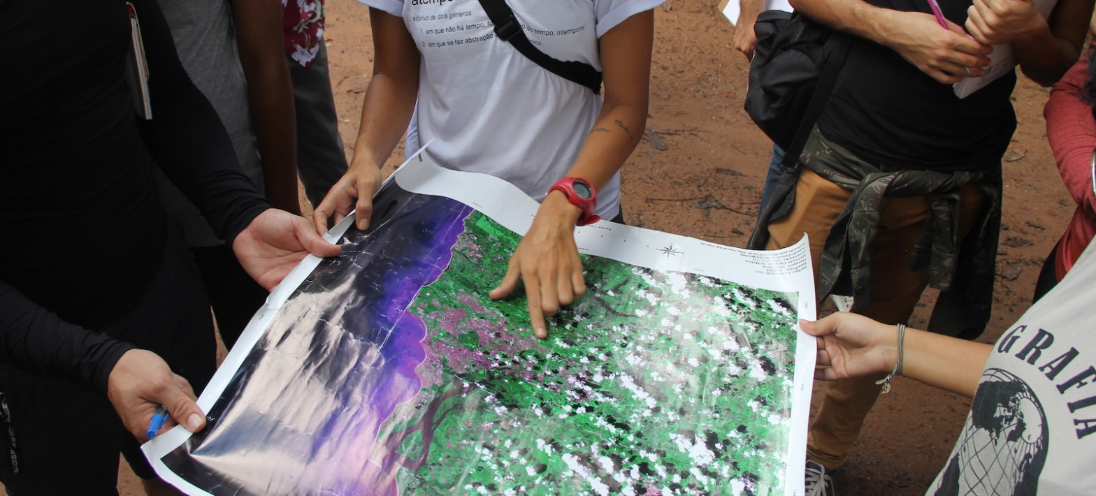
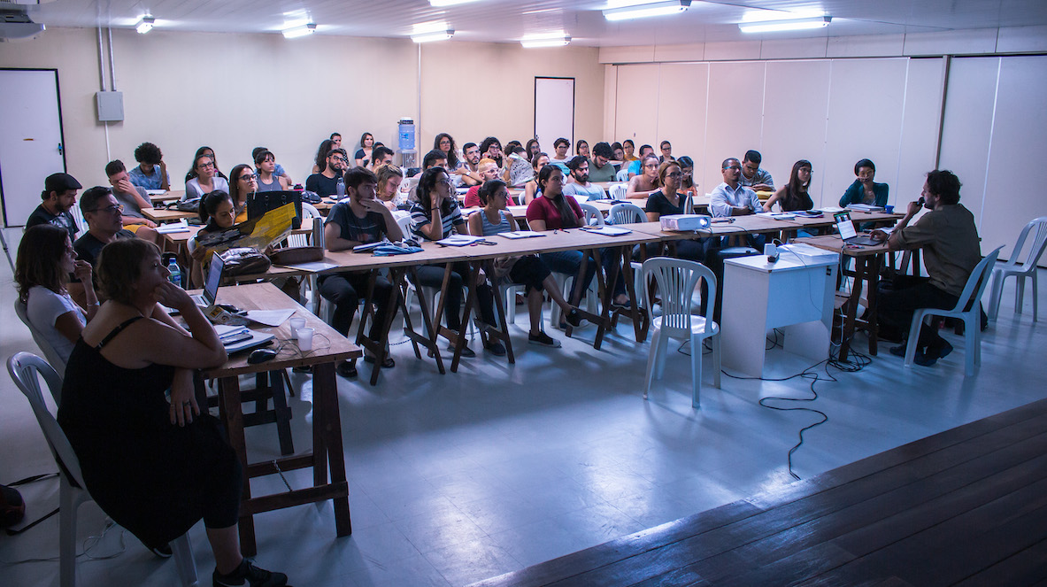
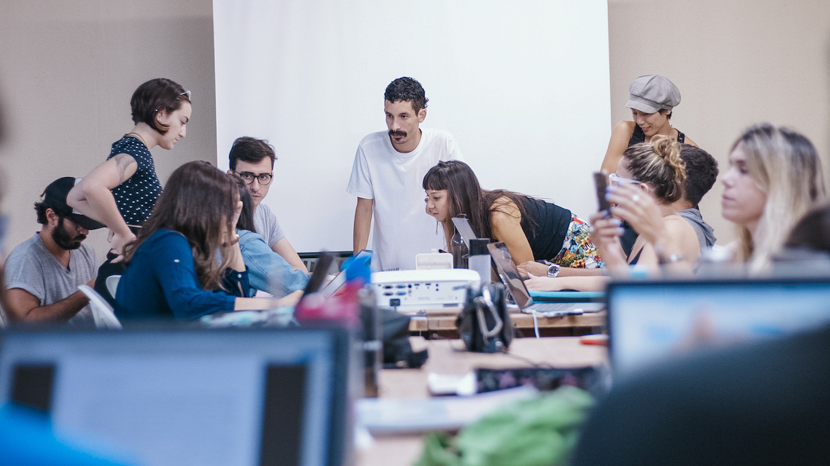
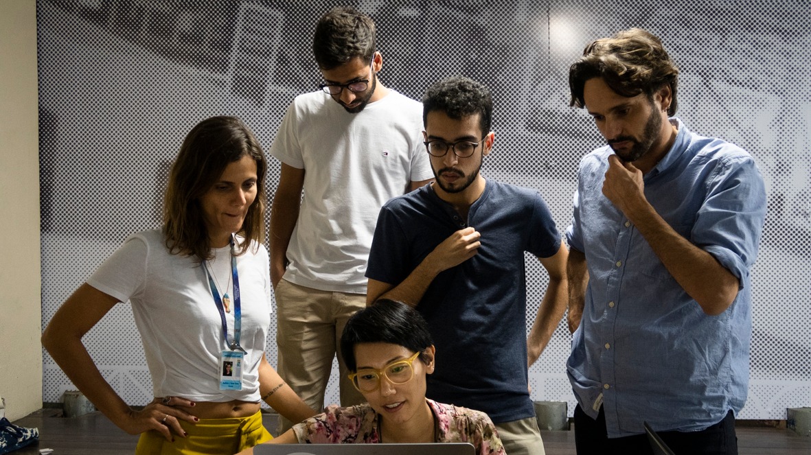
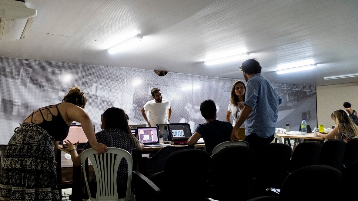
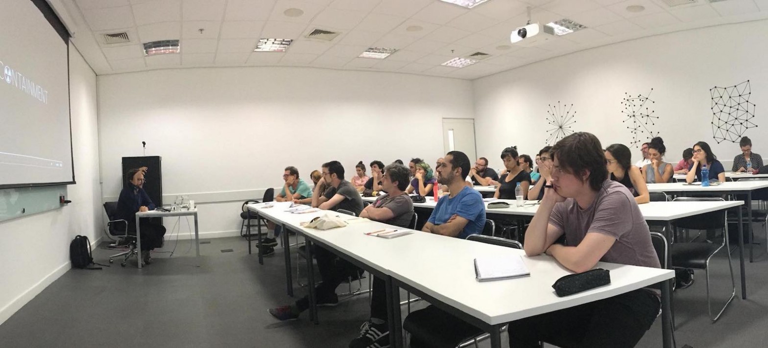
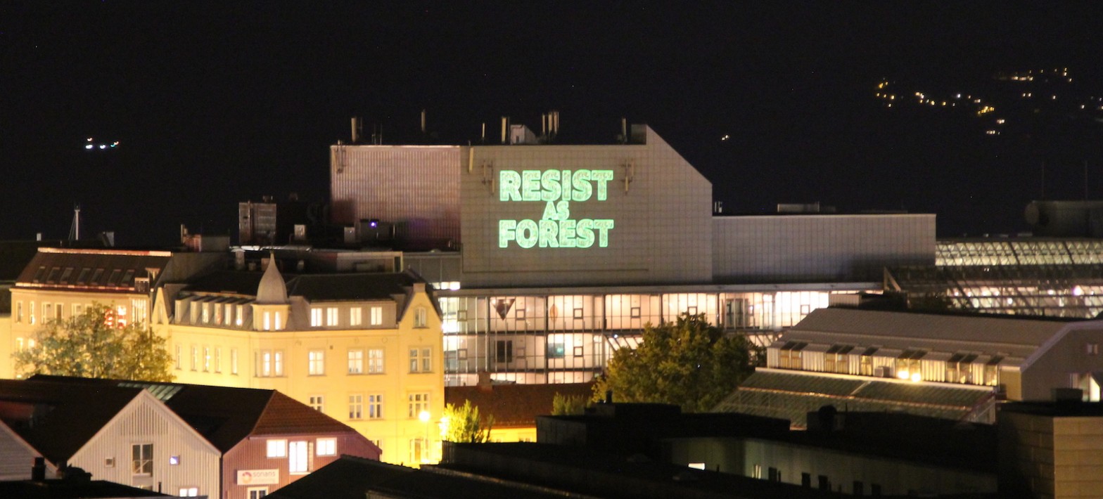
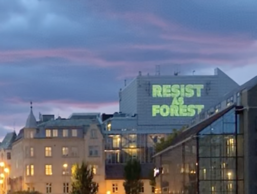
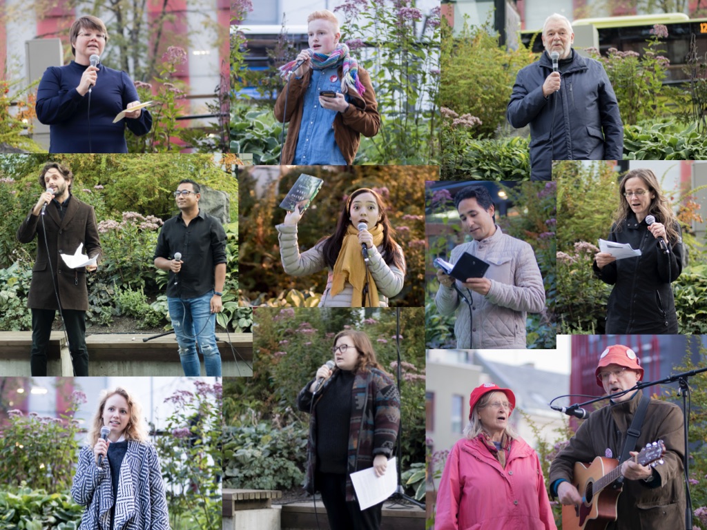
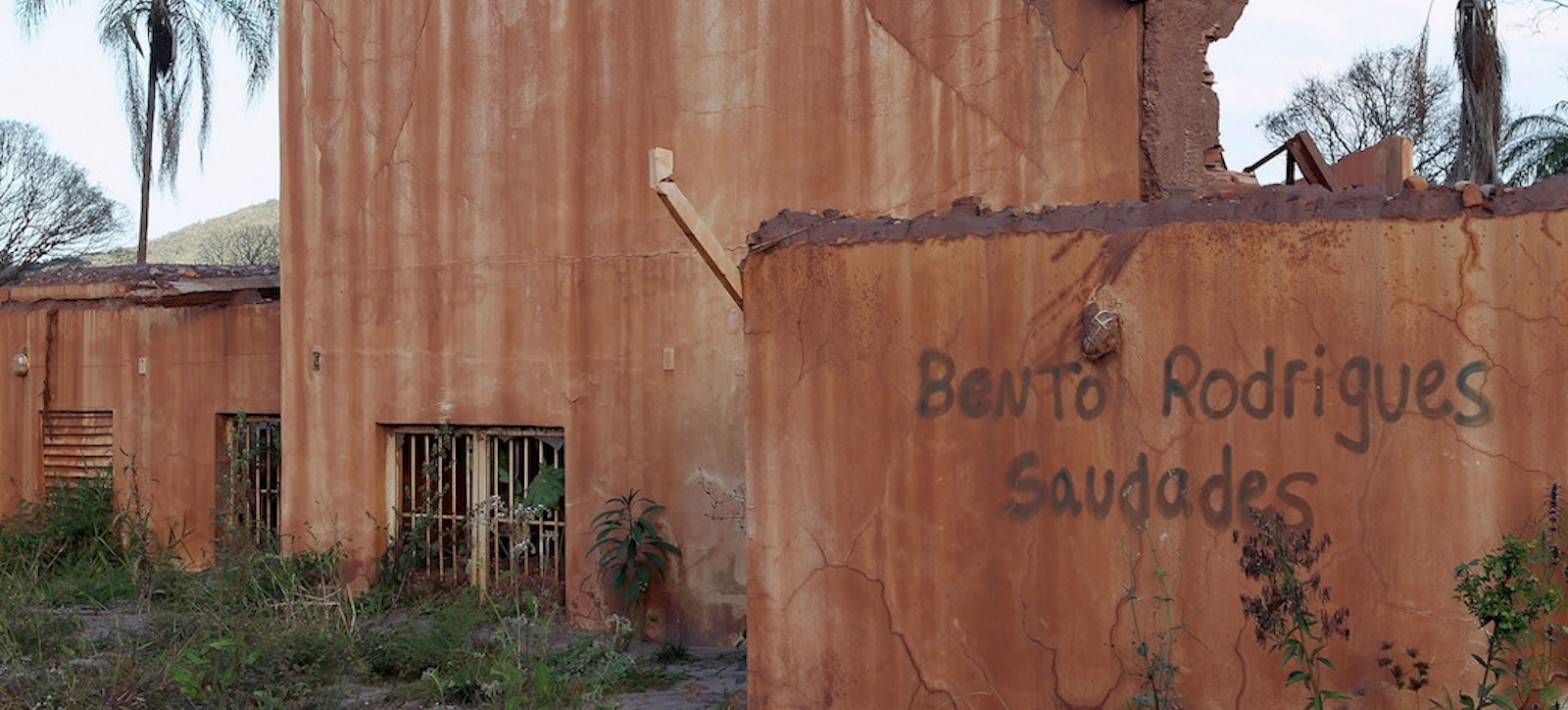
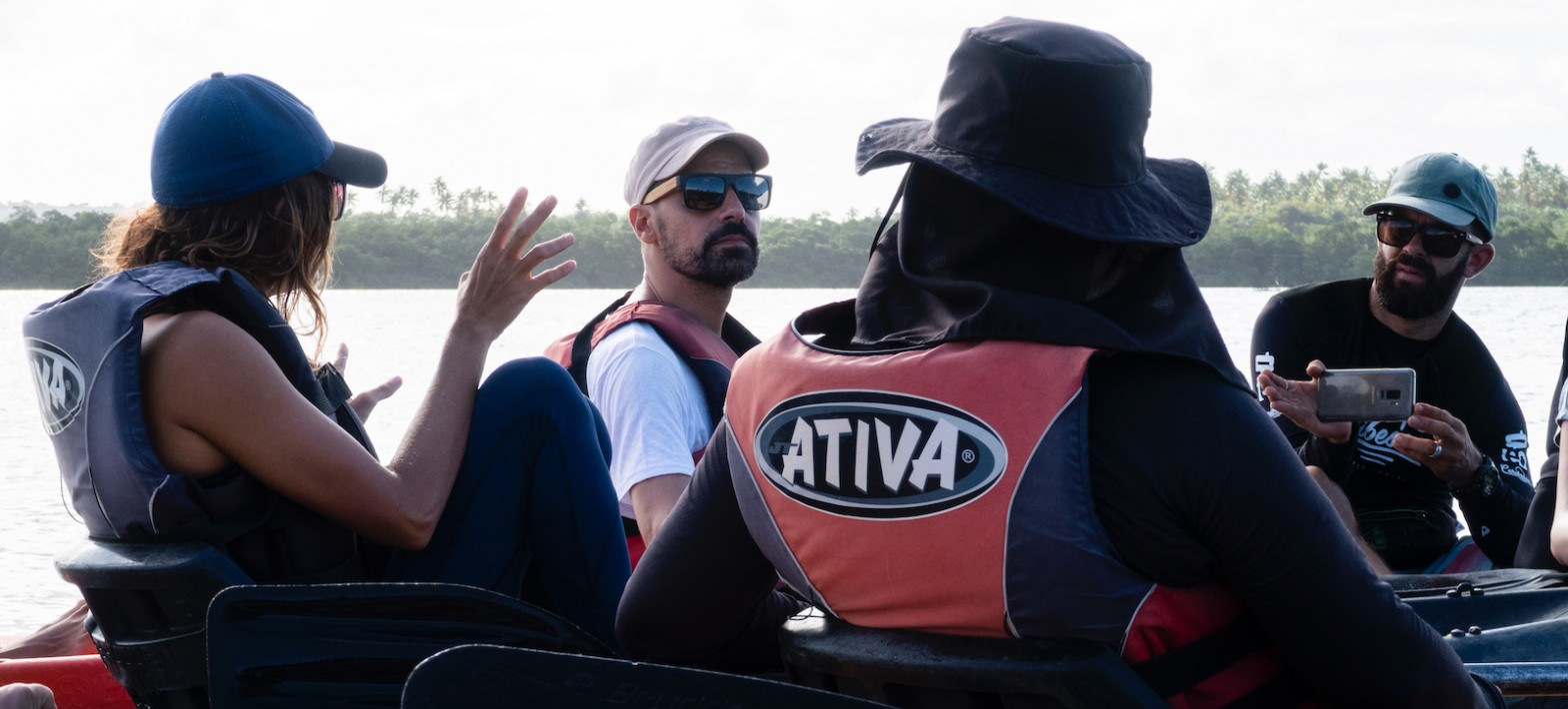
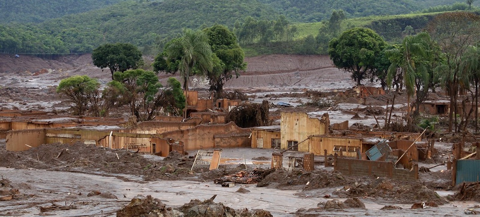

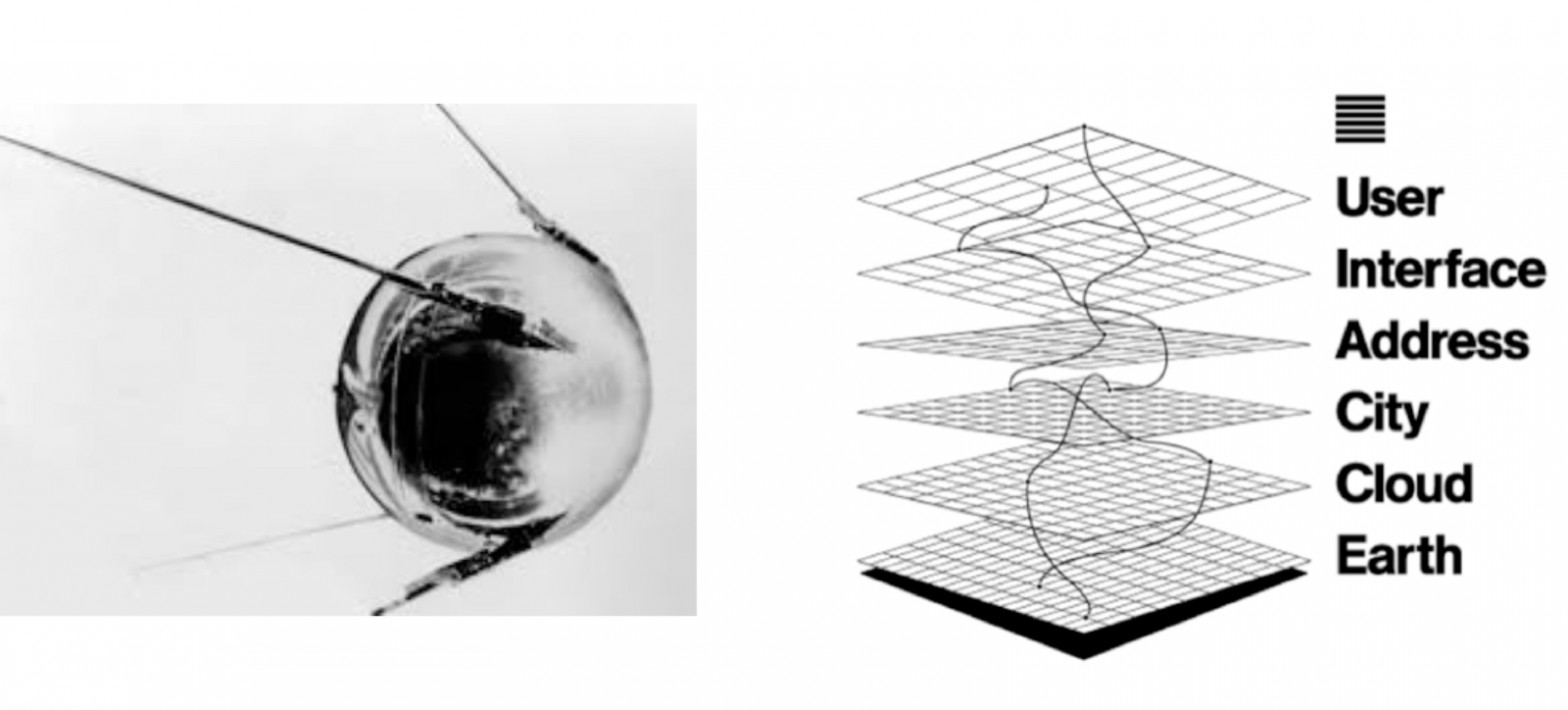
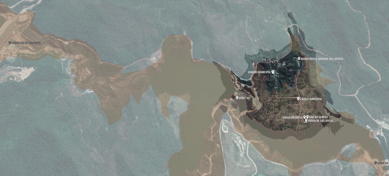
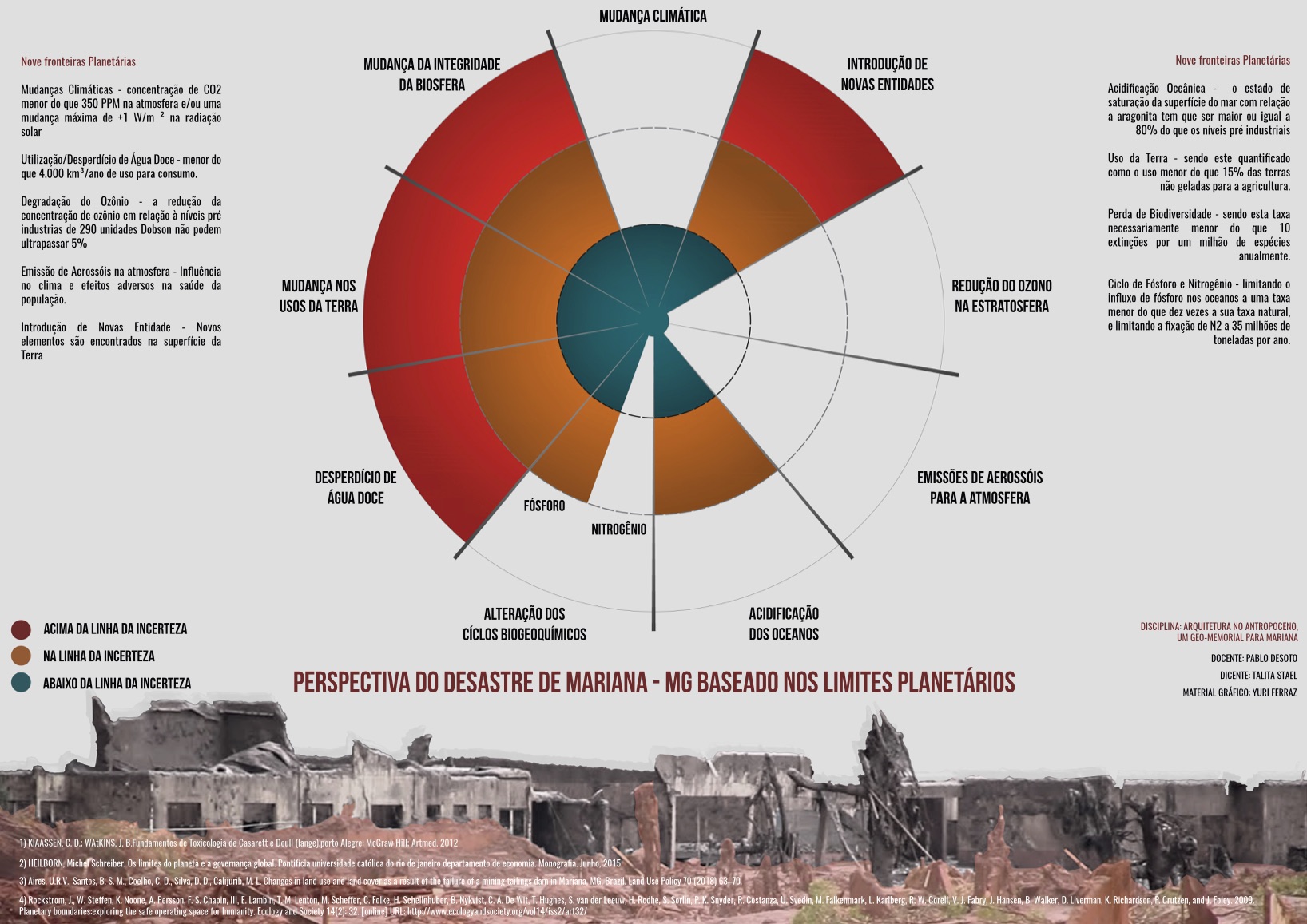
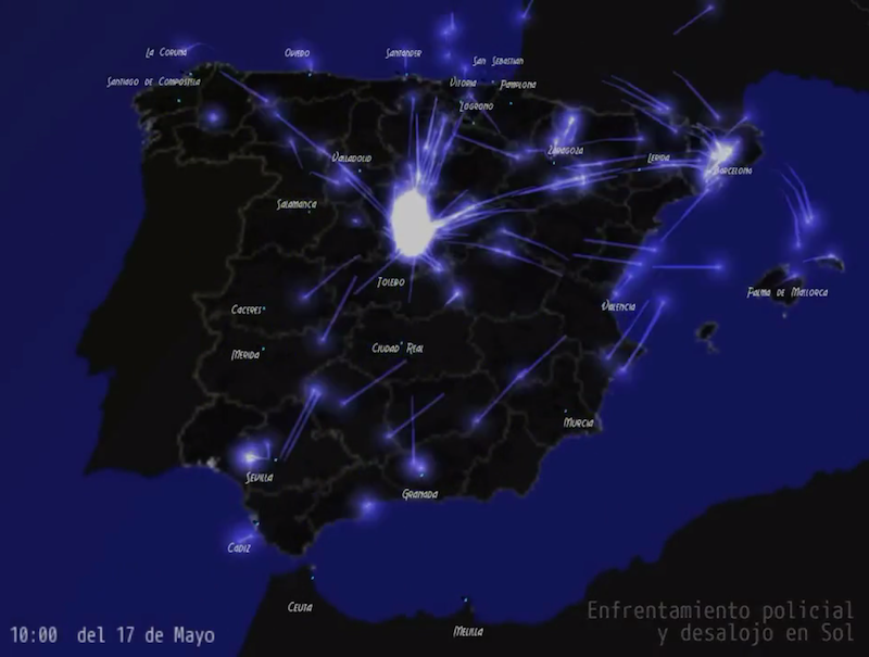
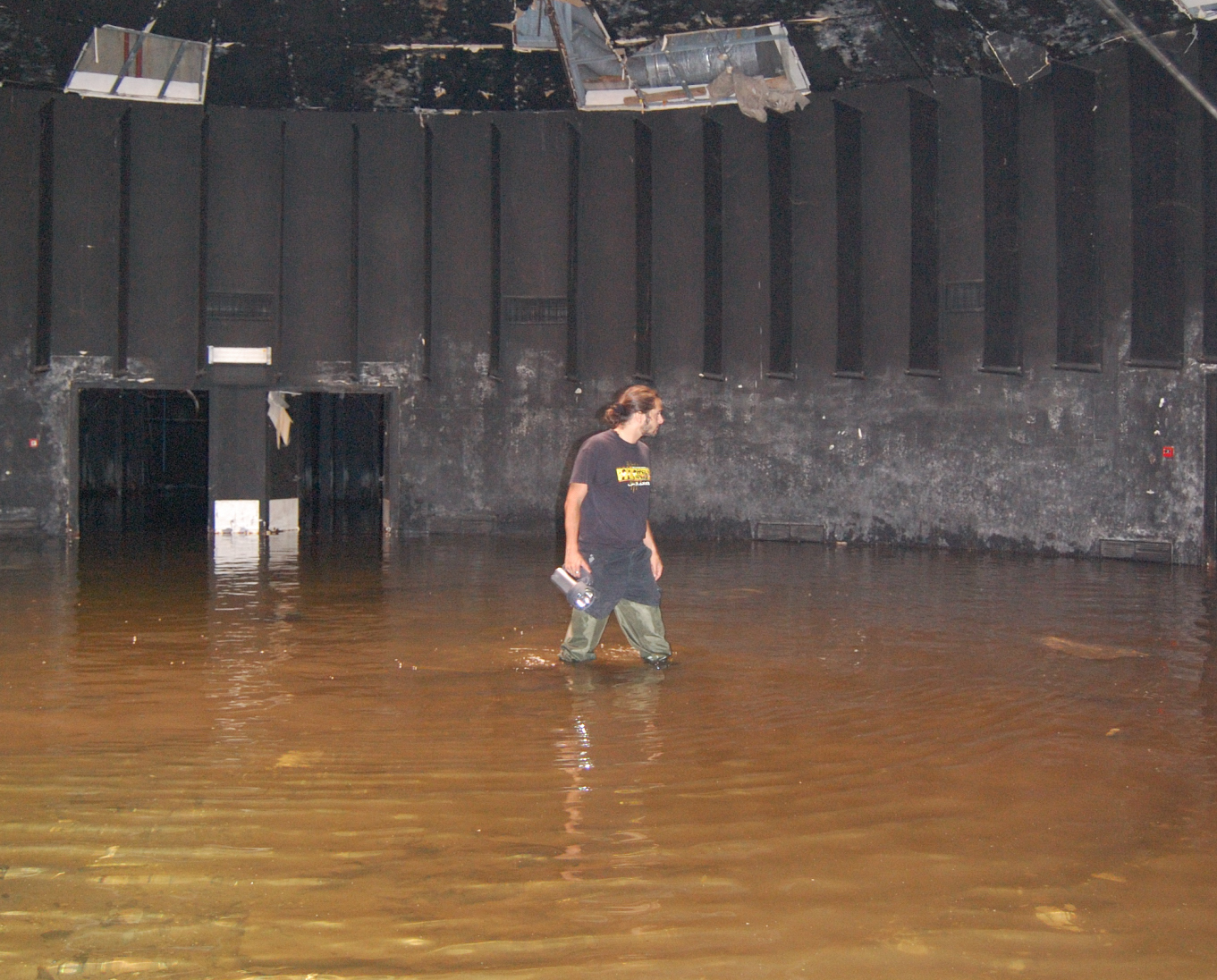
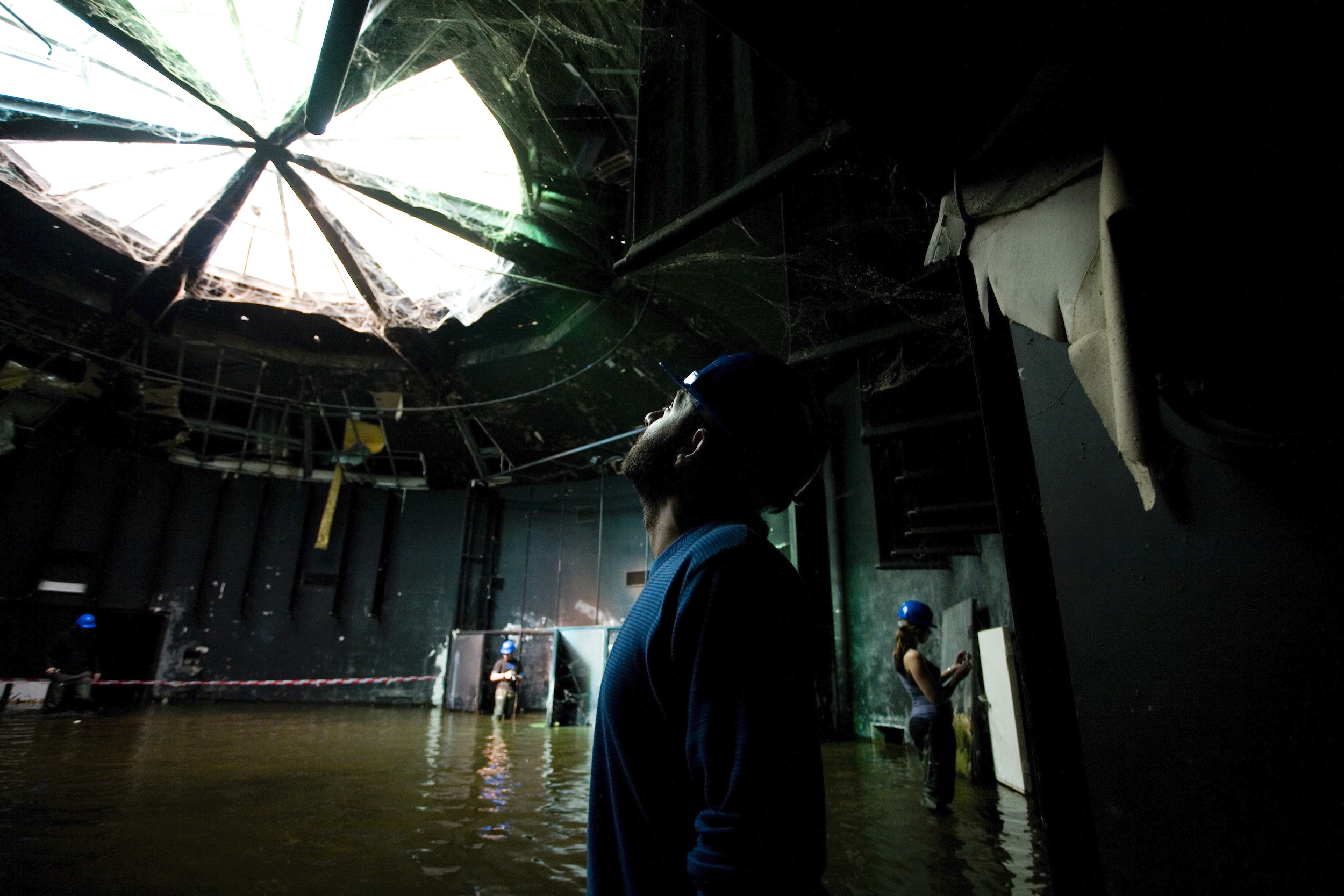
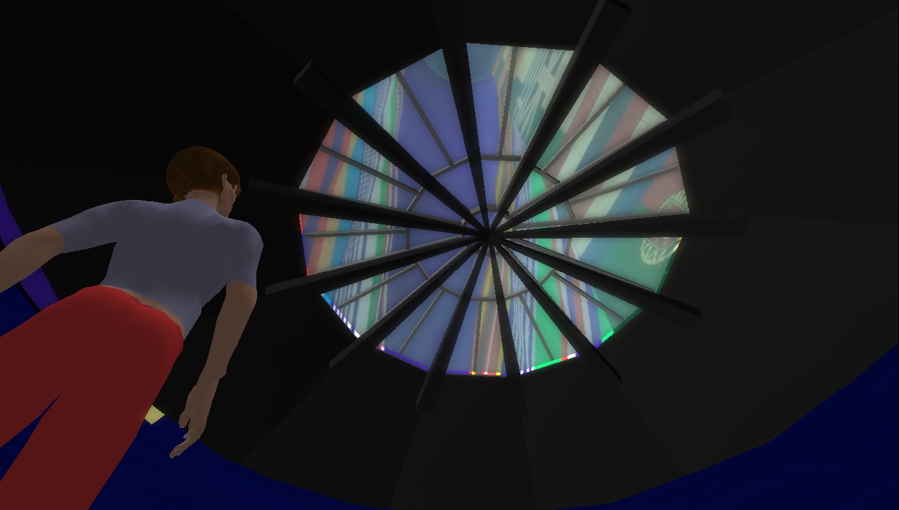
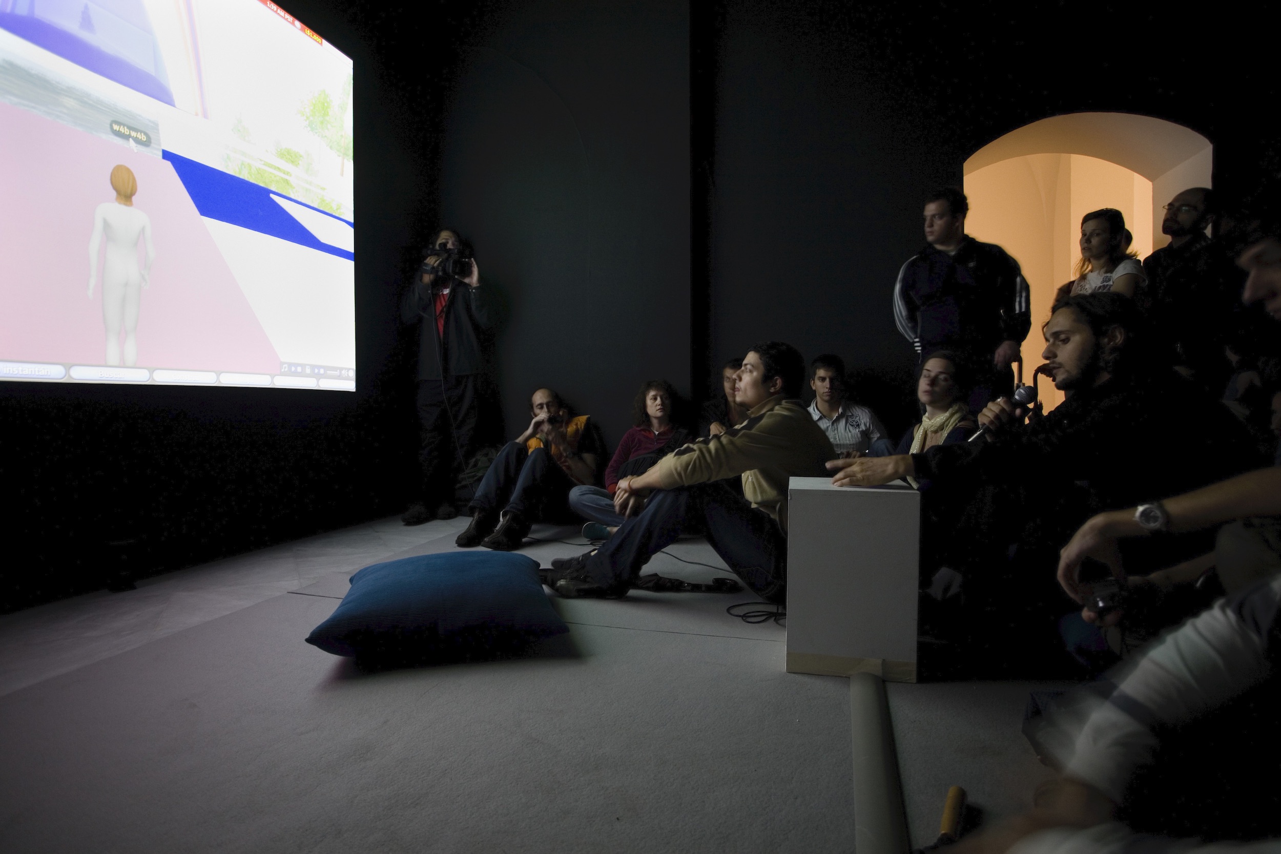
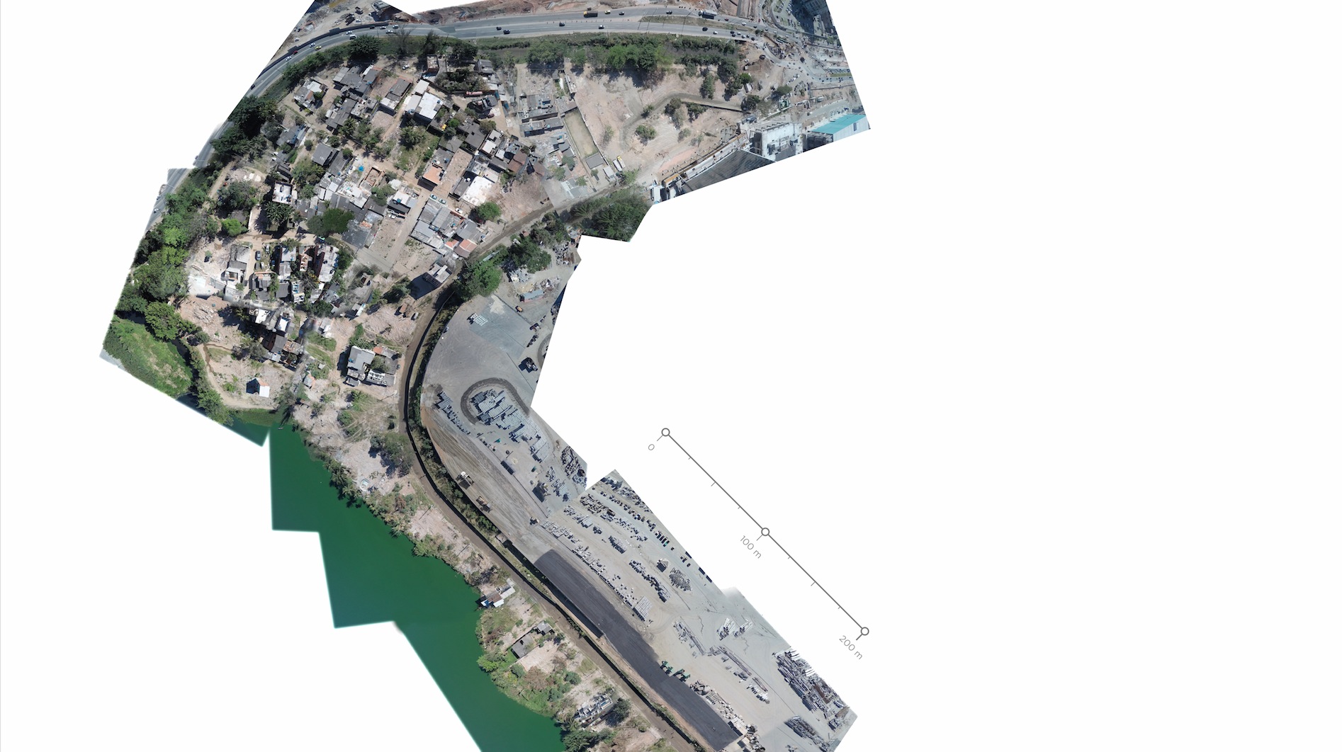
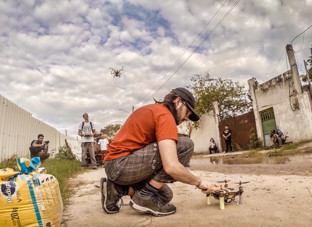

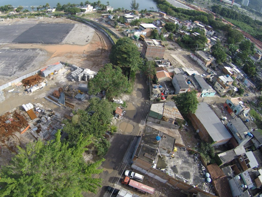
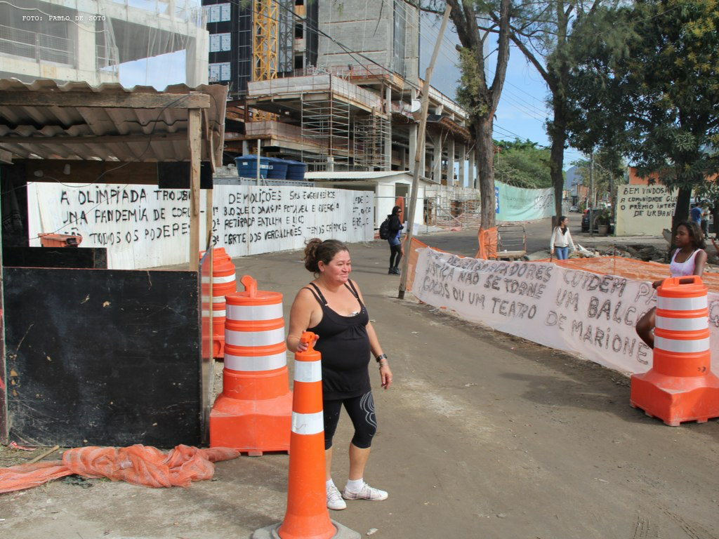
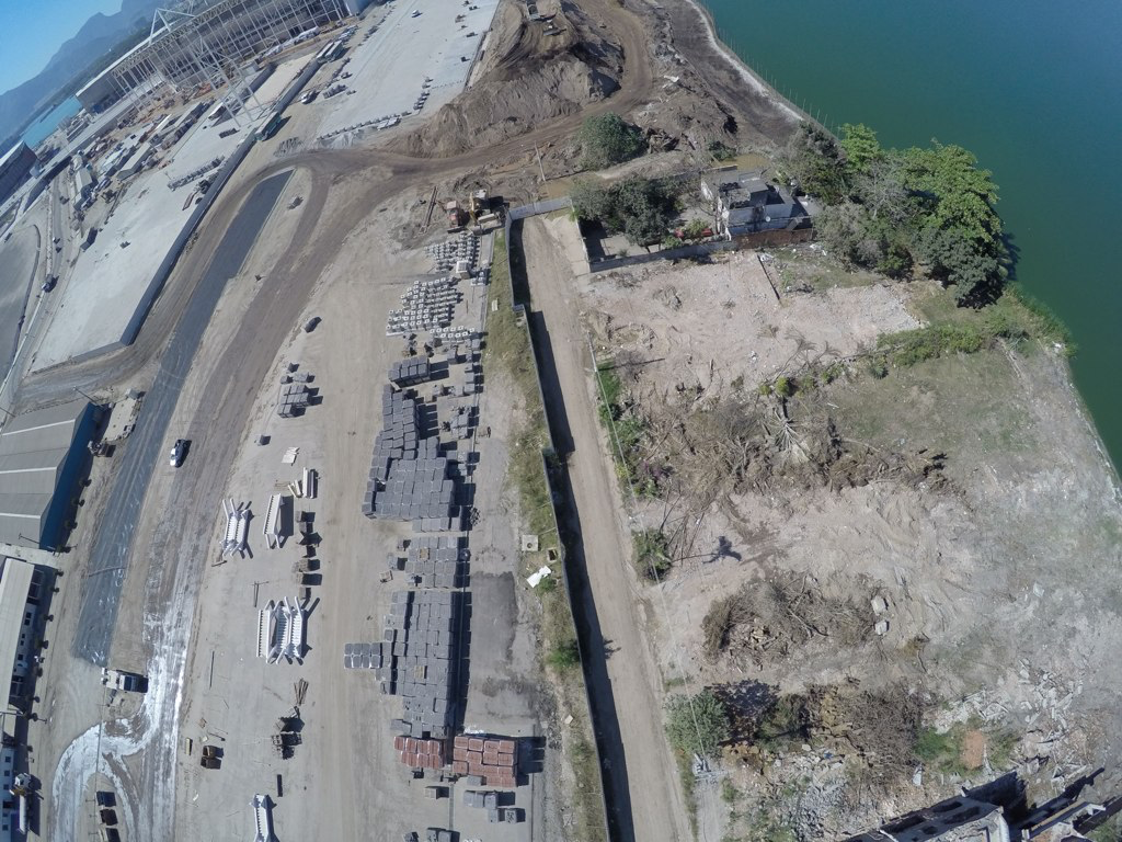
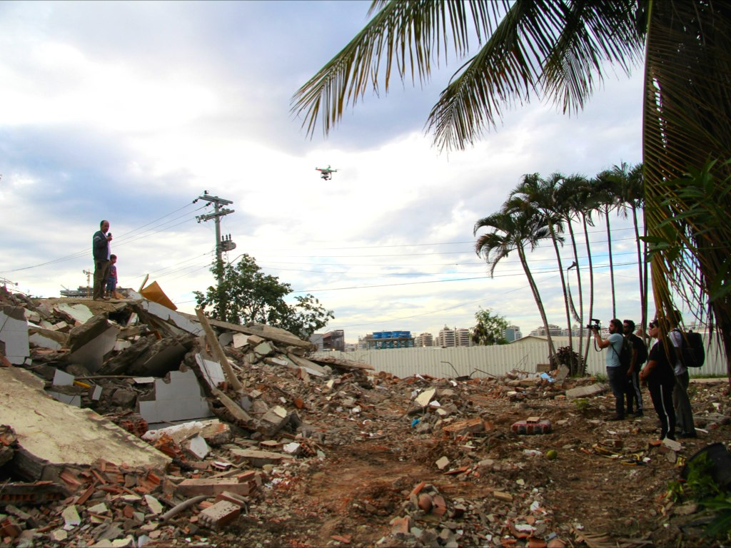
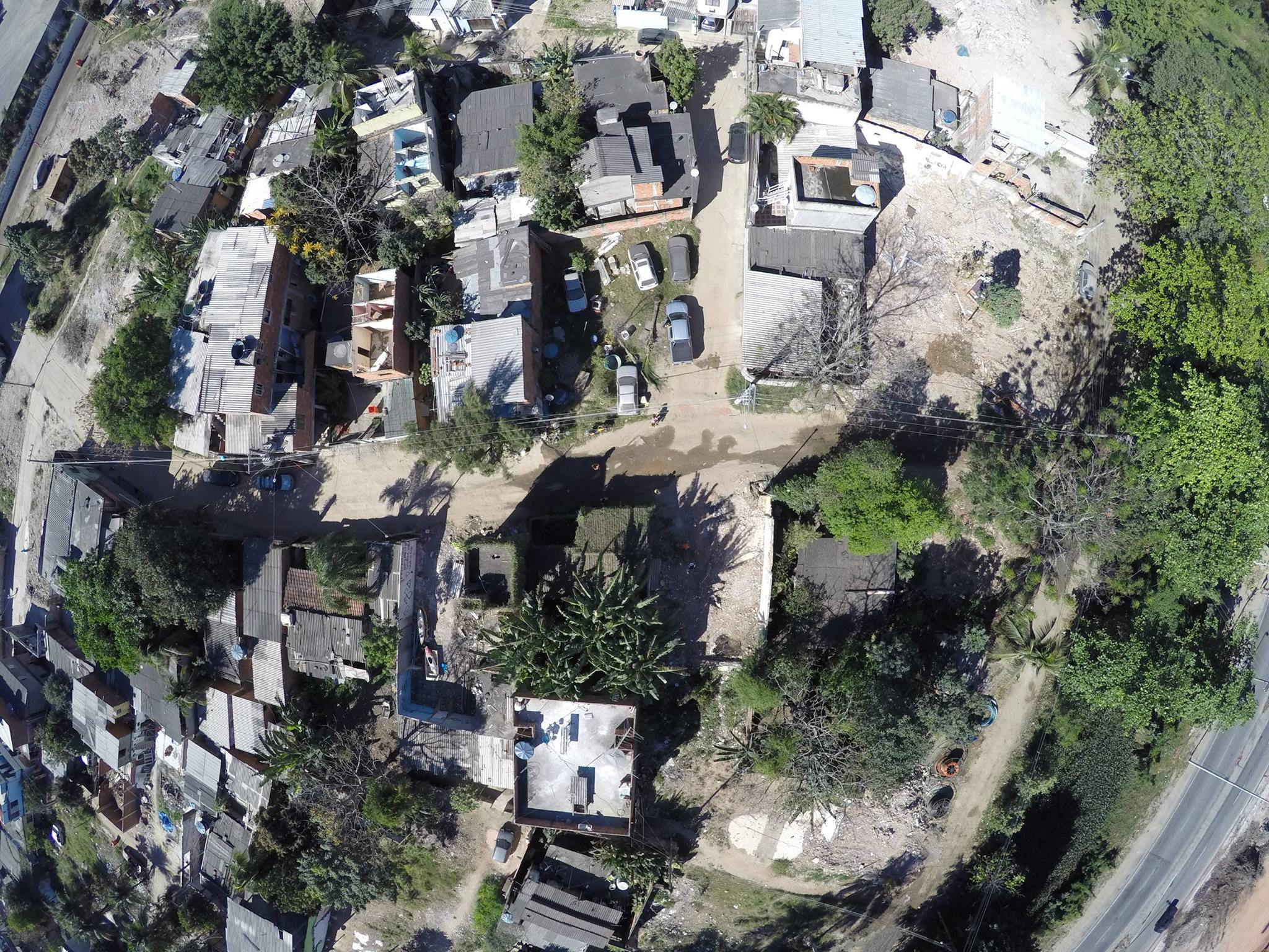
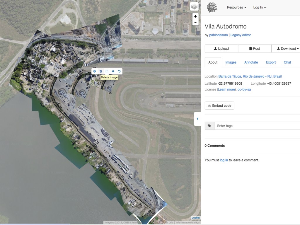

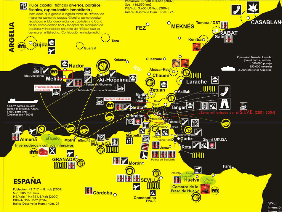

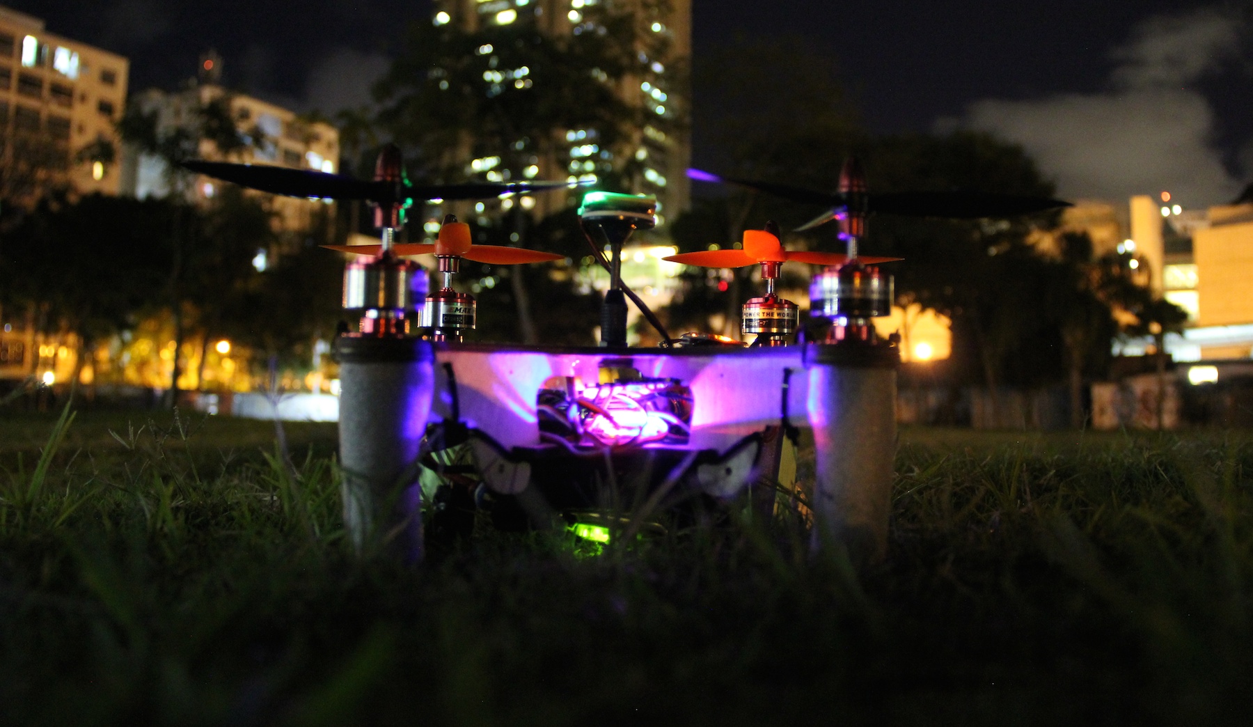
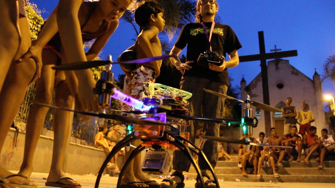
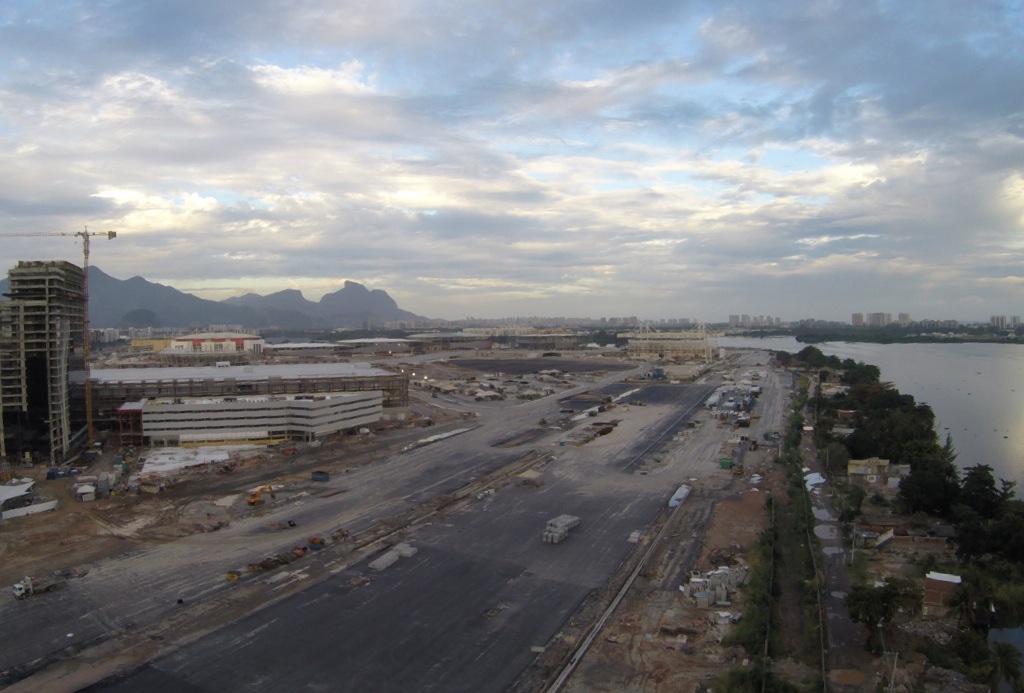
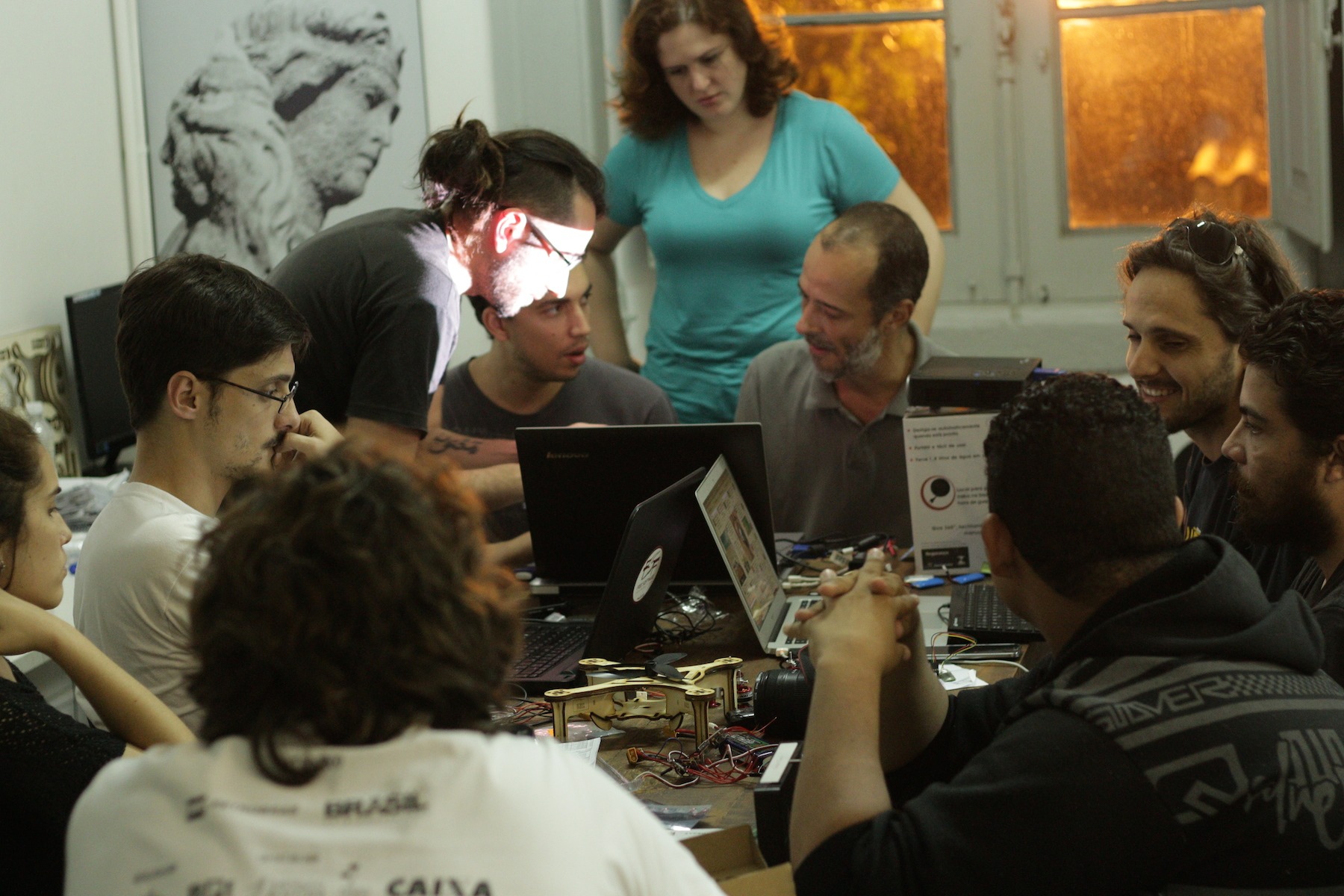
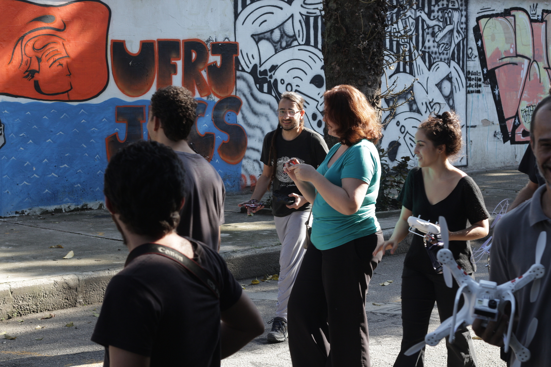
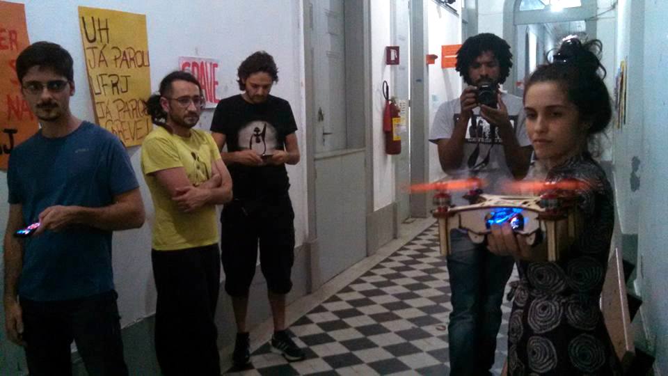
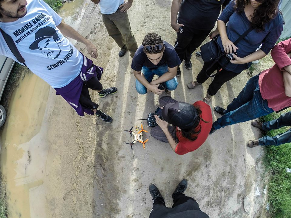
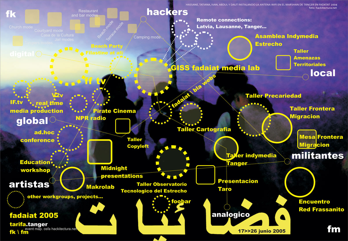
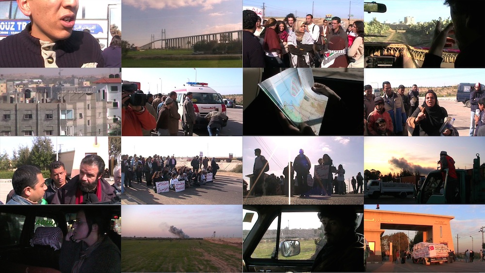
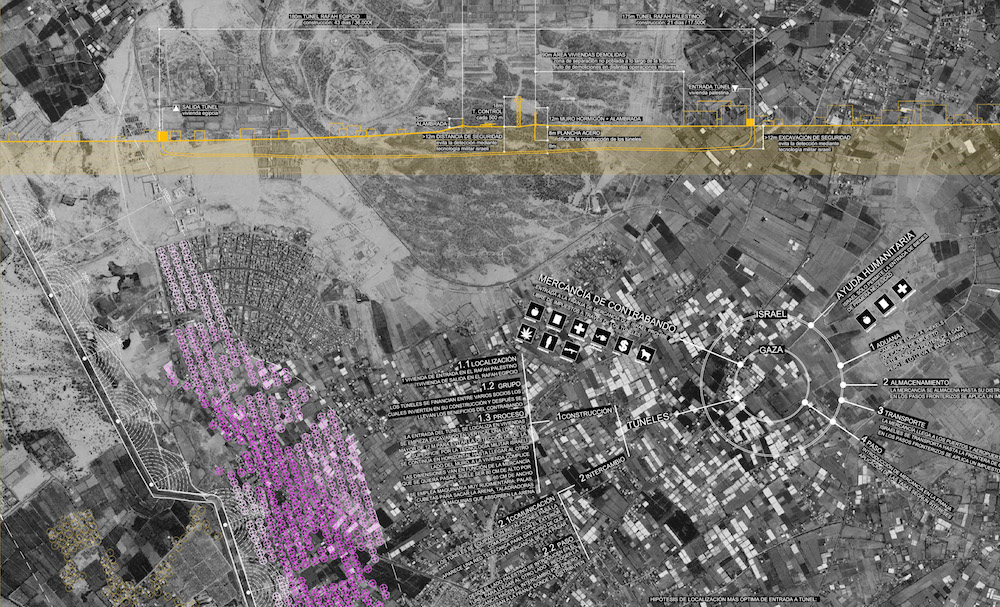
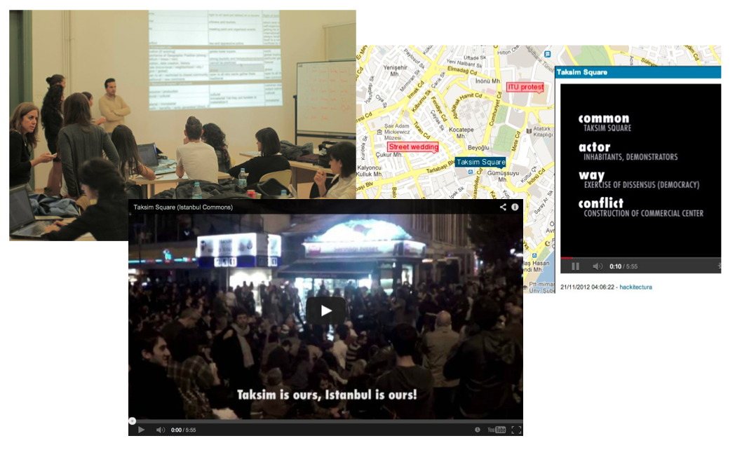
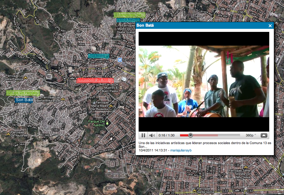
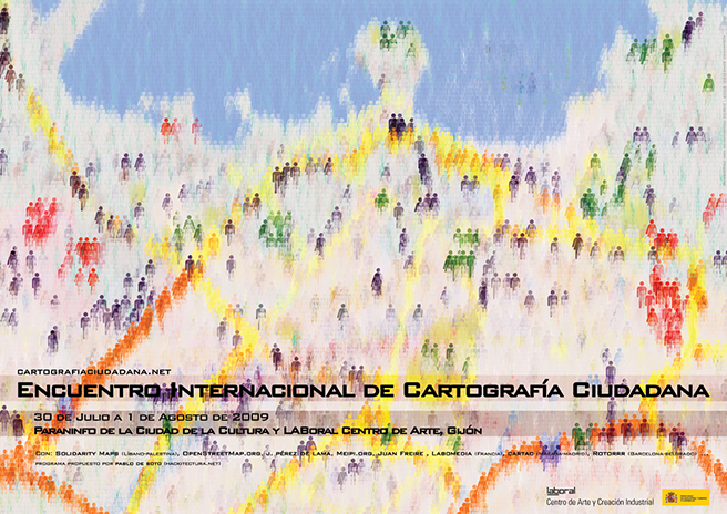
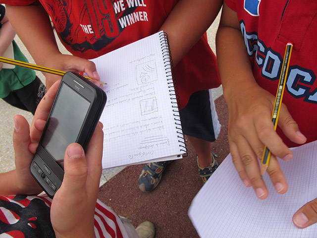
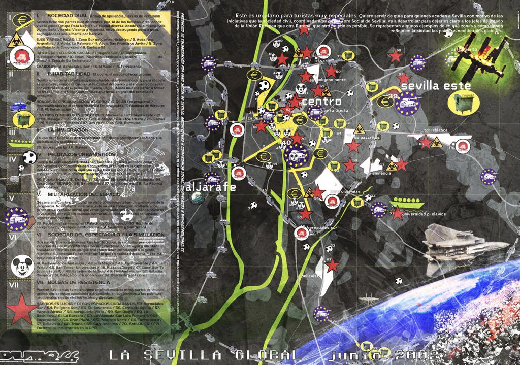
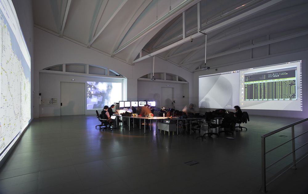
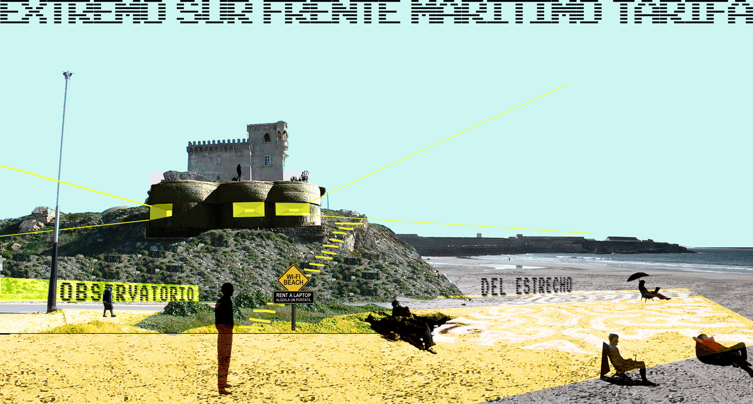
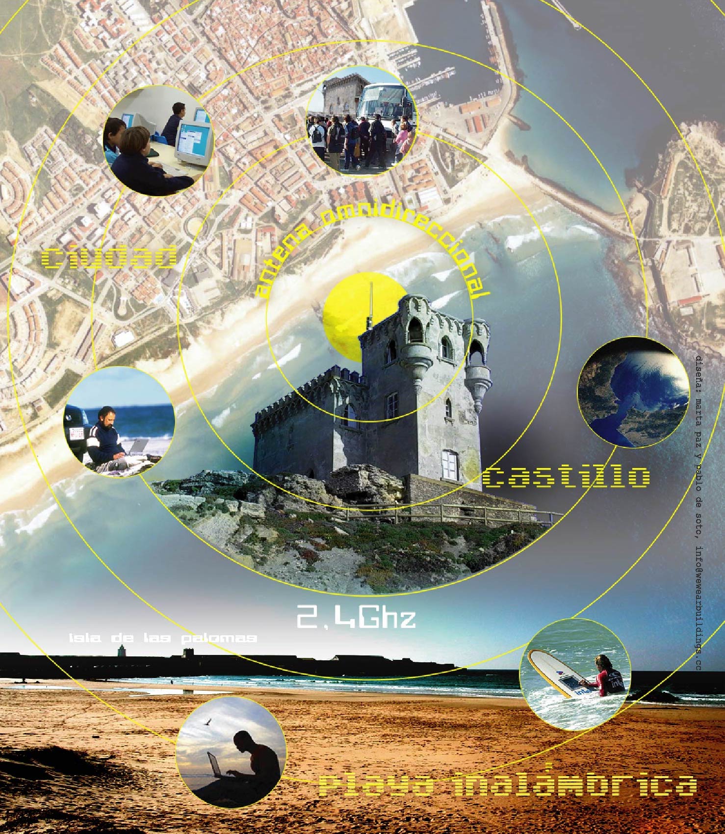


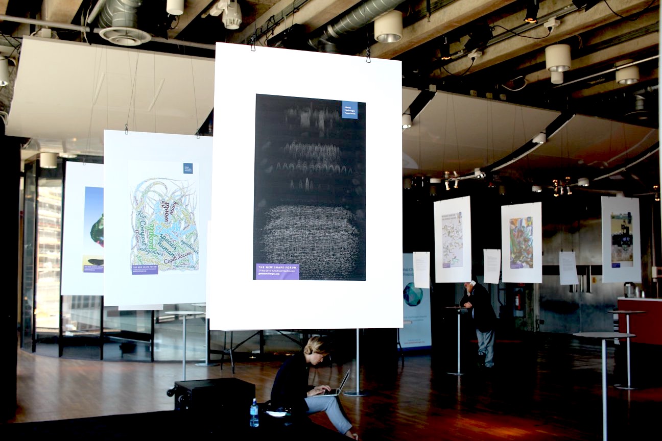

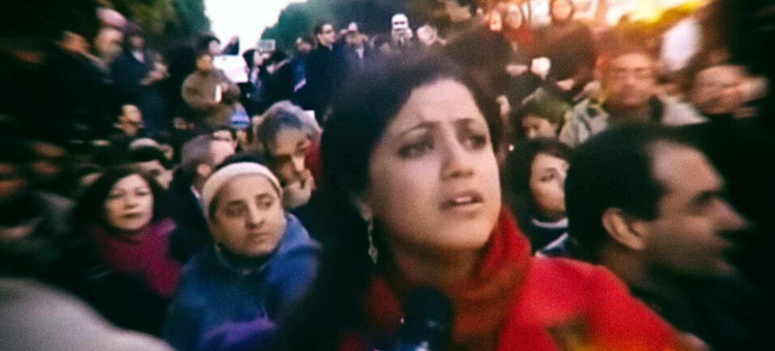
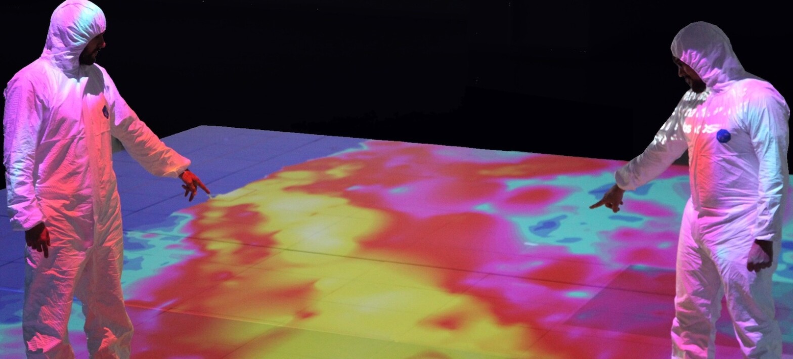
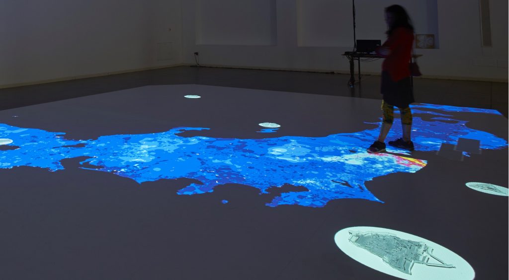
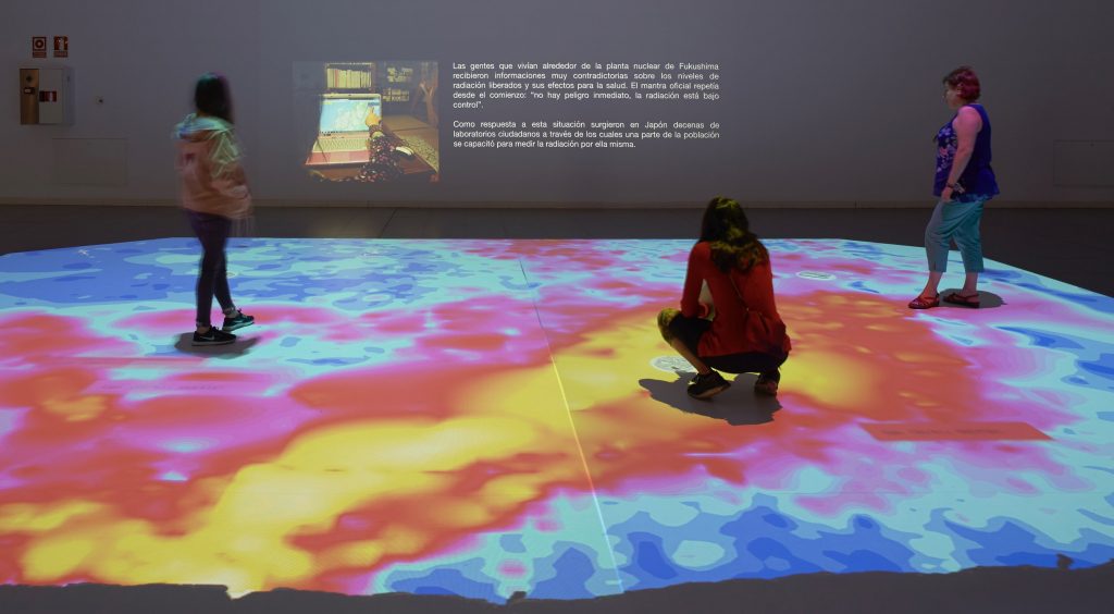
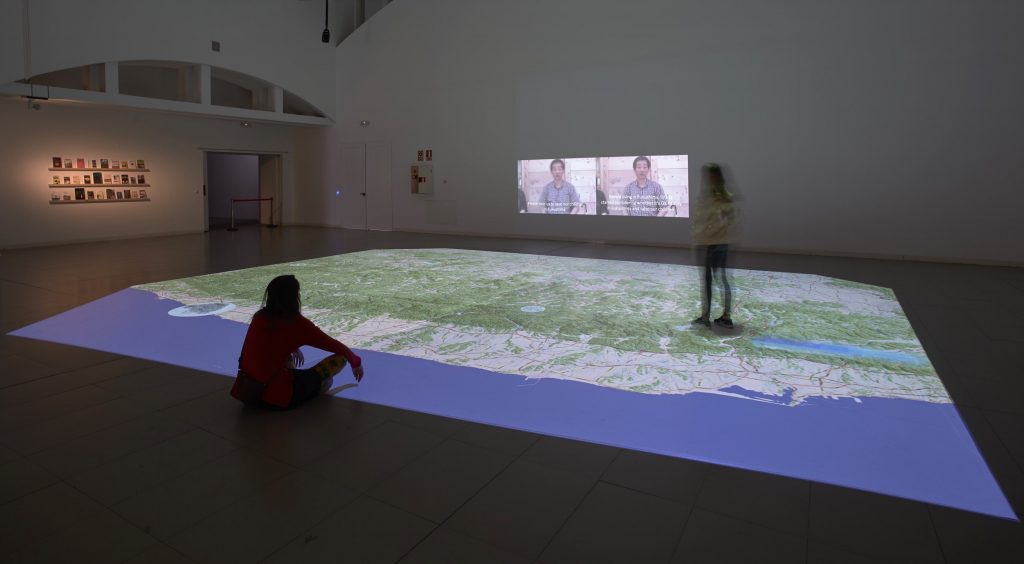
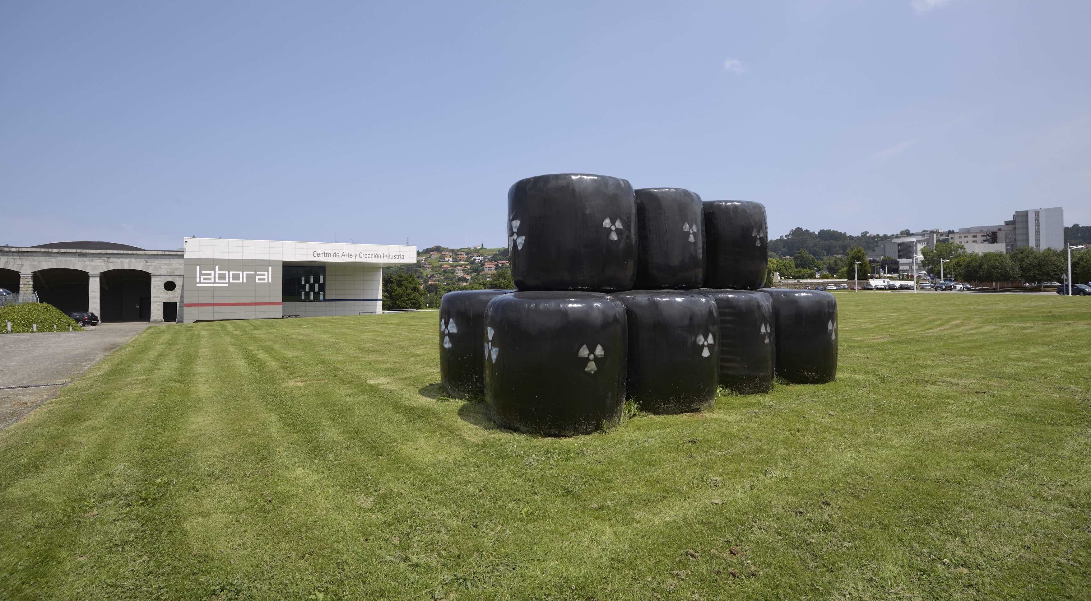
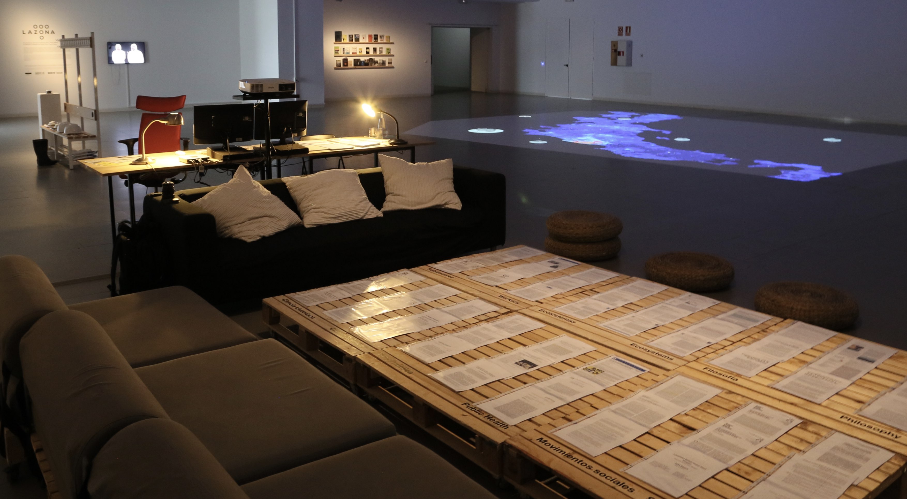
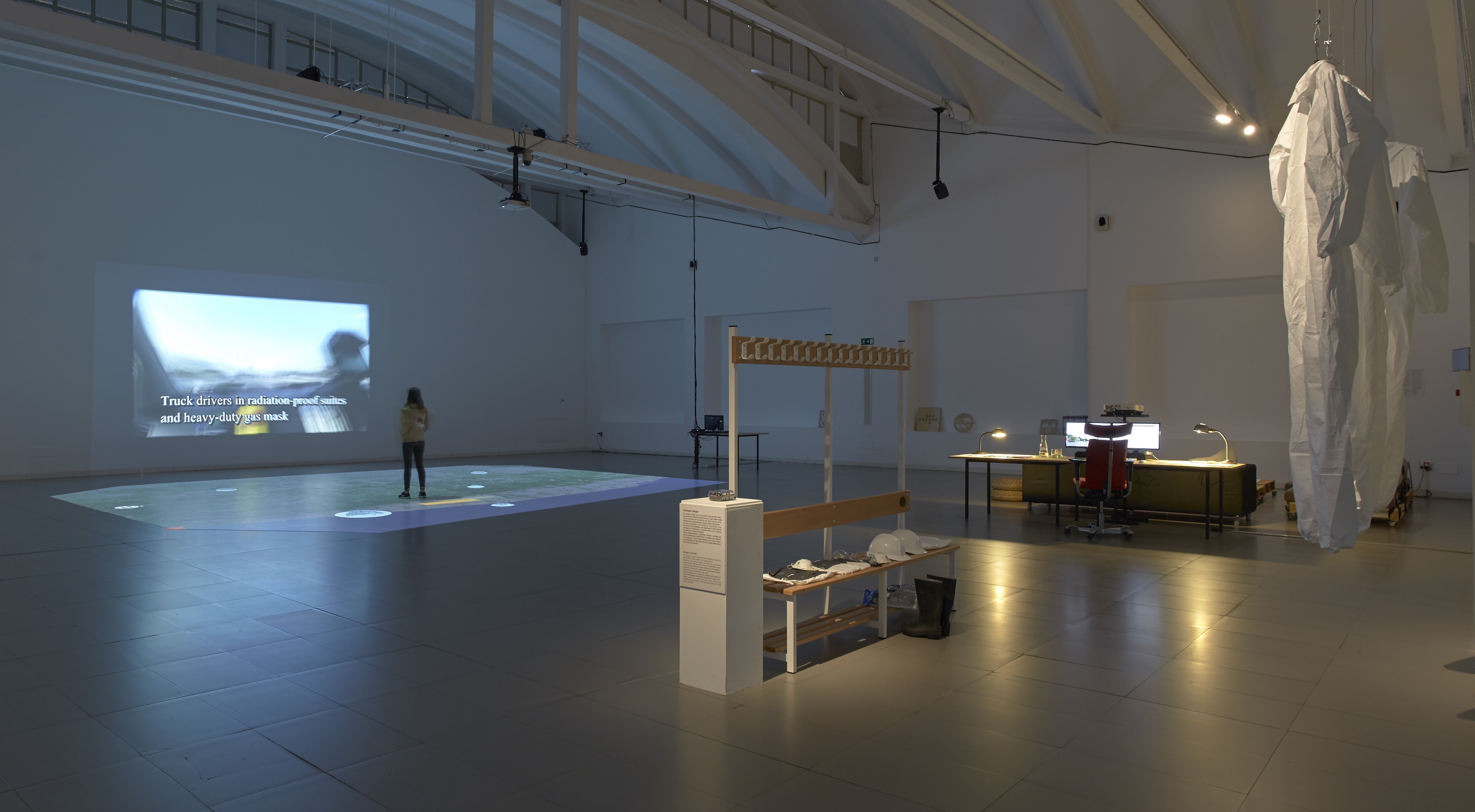
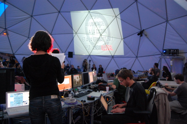
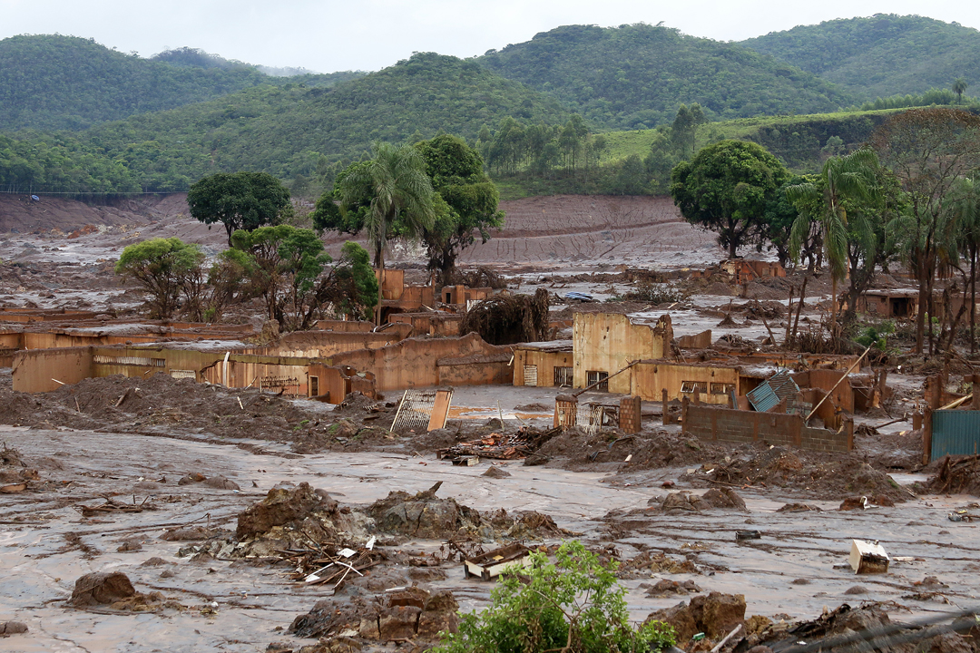
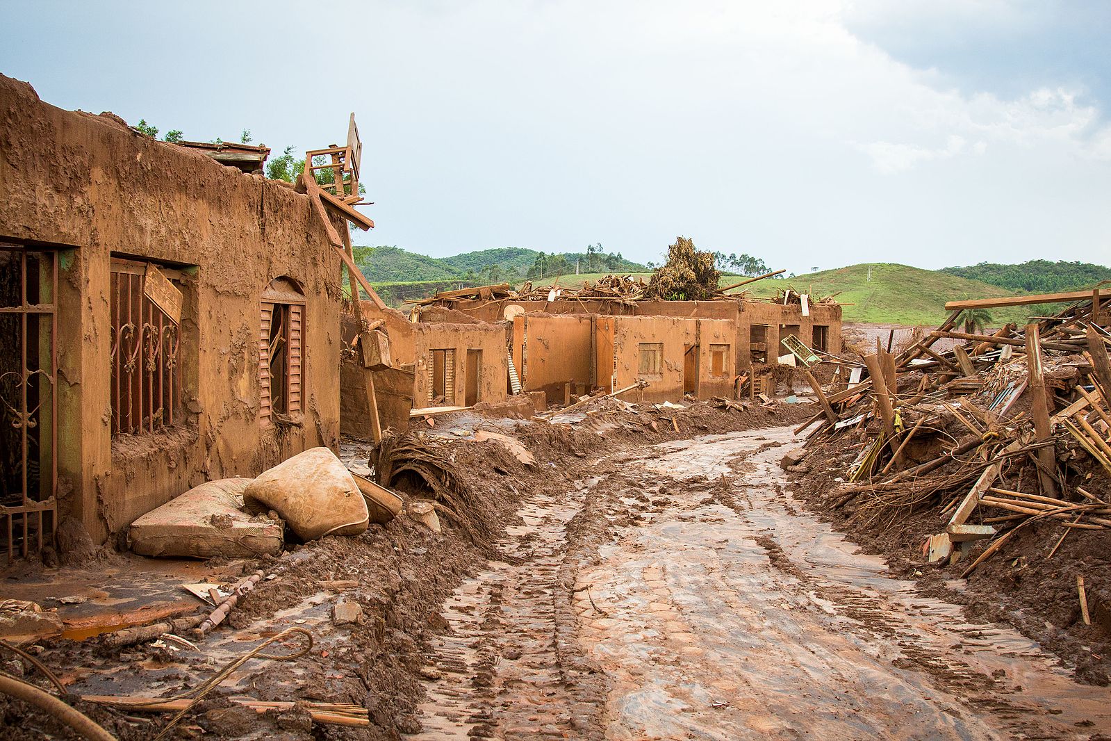
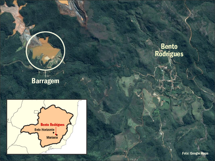
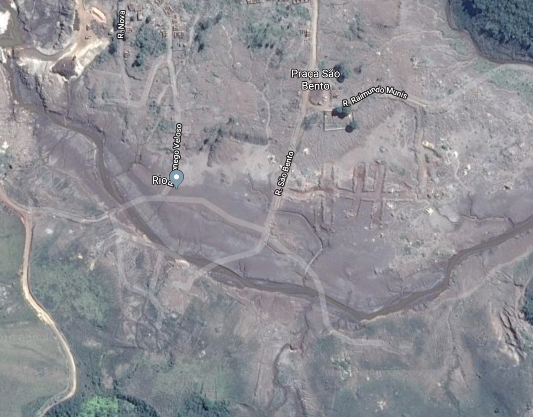
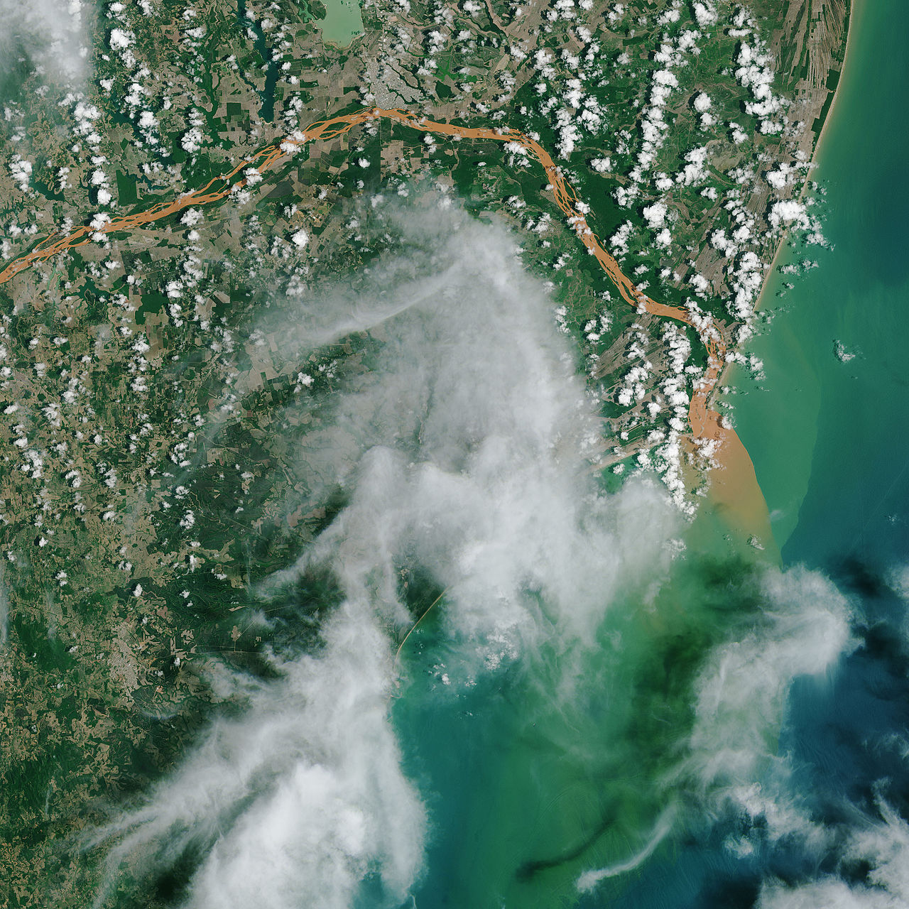
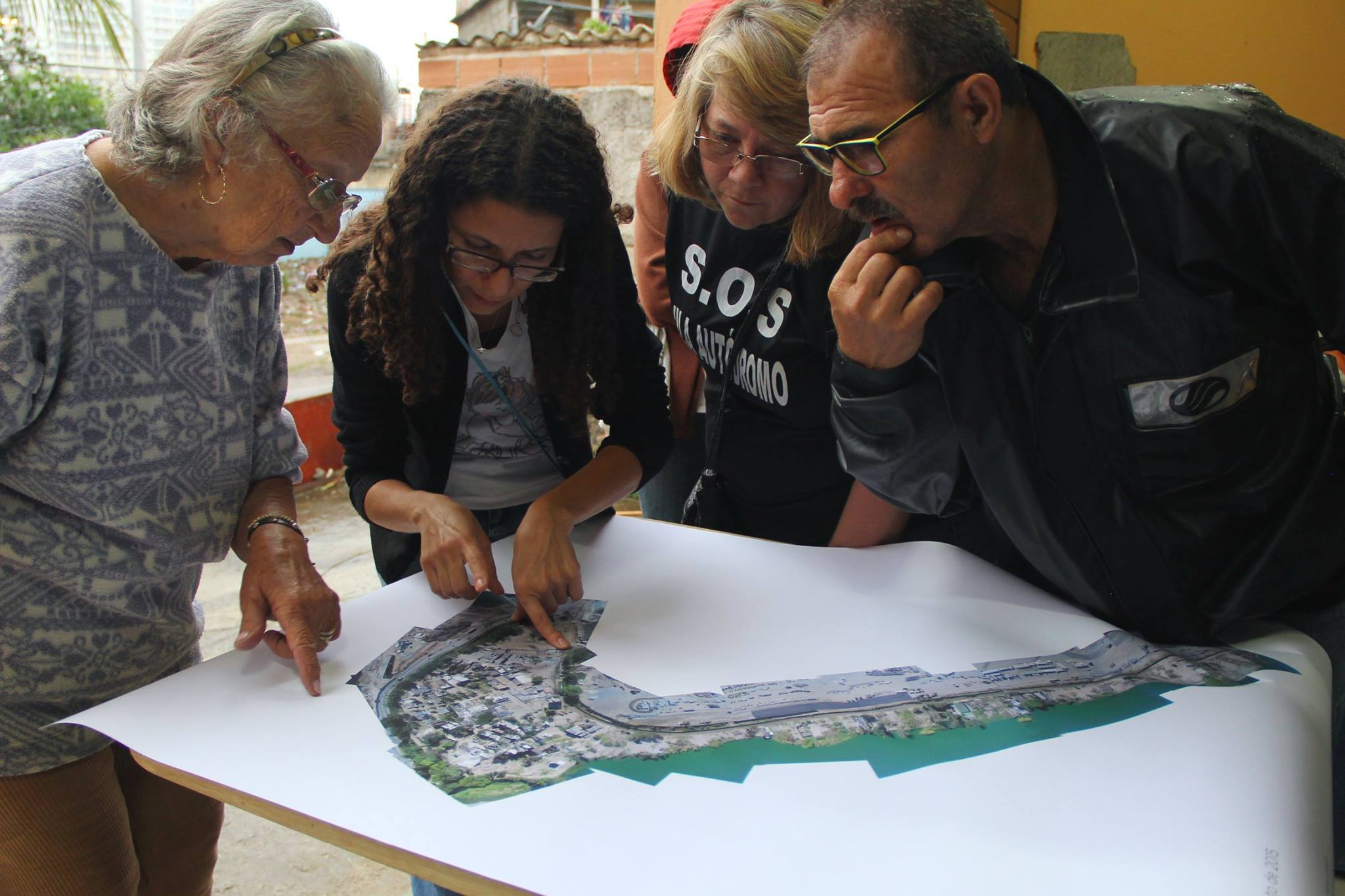